 |
|
Chatham-Kent Municipal Airport, (IATA: XCM, ICAO: CYCK), is located 6 nautical miles (11 km; 6.9 mi) southeast of Chatham-Kent, Ontario, Canada.
The Chatham-Kent Municipal Airport is owned and operated by the Municipality of Chatham–Kent. The airport is managed by Z3 Aviation. Several local pilots and businesses are tenants at the airport in the various hangars.
The airport is operational 9 hours per day, 7 days per week and is capable of supporting both VFR) and IFR operations down to 510 ft (160 m) and 1 1⁄2 mi (2.4 km) visibility non-precision approach limits and departures in visibility down to 1⁄2 mi (0.8 km).
Chatham-Kent Municipal Airport was previously identified as CNZ3. This change occurred on September 20, 2012.
Chatham-Kent Airport
Chatham-Kent Municipal Airport |
|
|
| Summary |
| Airport type |
Public |
| Owner/Operator |
Municipality of Chatham–Kent |
| Location |
Chatham-Kent, Ontario |
| Time zone |
EST (UTC−05:00) |
| Summer (DST) |
EDT (UTC−04:00) |
| Elevation AMSL |
645 ft / 197 m |
| Coordinates |
42°18′22″N
082°04′54″W |
| Website |
www.chatham-kent.ca/.../ChathamAirport |
| Map |
|
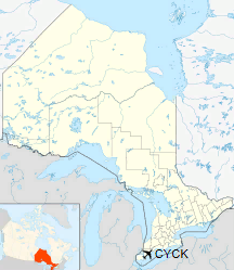
Location in Ontario
|
| Runways |
| Direction |
Length |
Surface |
| ft |
m |
06/24 |
5,502 |
1,677 |
Asphalt |
|
The above content comes from Wikipedia and is published under free licenses – click here to read more.
| General Info
|
| Country |
Canada
|
| Time |
UTC-5(-4DT)
|
| Latitude |
42.306389
42° 18' 23.00" N
|
| Longitude |
-82.081944
082° 04' 55.00" W
|
| Elevation |
650 feet
198 meters
|
| Type |
Civil
|
| Magnetic Variation |
008° W (02/06)
|
| Beacon |
Yes
|
| Operating Agency |
CIVIL GOVERNMENT, (LANDING FEES AND DIPLOMATIC CLEARANCE MAY BE REQUIRED)
|
| Operating Hours |
24 HOUR OPERATIONS
|
| International Clearance Status |
Airport of Entry
|
| Daylight Saving Time |
Second Sunday in March at 0200 to first Sunday in November at 0200 local time (Exception Arizona and that portion of Indiana in the Eastern Time Zone)
|
| Communications
|
CTAF/UNICOM
UNICOM opr ltd hr.
|
123.2
|
| CLEVELAND CNTR |
132.25
|
| Communications Remarks |
|
| CNTR |
(APP/DEP svc)
|
| Runways
|
ID
|
Dimensions |
Surface |
PCN |
ILS
|
| 06/24 |
5000 x 75 feet
1524 x 23 meters |
ASPHALT |
- |
NO
|
| Navaids
|
| Type |
ID |
Name |
Channel |
Freq |
Distance From Field |
Bearing From Navaid
|
| NDB |
4L |
CHATHAM |
- |
236 |
At Field |
-
|
| Supplies/Equipment
|
| Fuel |
Jet A1, without icing nhibitor.
100/130 octane gasoline, leaded, MIL-L-5572F (GREEN)
|
| Remarks
|
| CAUTION |
Glider and PJE haz. Heliport lctd 2.5 NM W.
|
| FUEL |
(NC-100, A1 - Call out fee may be levied.)
|
| LGT |
ACTIVATE-LIRL Rwy 05-23-CTAF.
|
The content above was published at Airports-Worldwide.com in 2018.
We don't guarantee the information is fresh and accurate. The data may
be wrong or outdated.
For more up-to-date information please refer to other sources.
|
|


