|
|
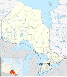
Brampton-Caledon Airport, (TC LID: CNC3), is a privately owned general aviation airport in Caledon, near Brampton, Ontario, Canada, northwest of Toronto.
The club and airport was established in 1946 and occupies 240 acres (0.97 km2) of land. The airport consists of two paved runways, a flight school building, terminal building, aircraft service and maintenance facilities and 25 storage hangars. It is the busiest uncontrolled airport in Canada by number of flights.
|
Brampton-Caledon Airport
|
- IATA: none
- ICAO: none
- TC LID: CNC3
|
| Summary |
| Airport type |
Public |
| Operator |
Brampton Flying |
| Location |
Caledon, Ontario |
| Time zone |
EST (UTC−05:00) |
| • Summer (DST) |
EDT (UTC−04:00) |
| Elevation AMSL |
936 ft / 285 m |
| Coordinates |
43°45′35″N
079°52′26″W |
| Website |
www.bramptonflightcentre.com/ |
| Map |
|
|
| Runways |
| Direction |
Length |
Surface |
| ft |
m |
| 15/33 |
3,500 |
1,067 |
Asphalt/Turf |
| 08/26 |
2,500 |
762 |
Asphalt/Turf |
|
History
The Brampton Flying Club first opened the airfield in 1946 on farmland and replaced a series of earlier landing strips near Highway 7 (Stan Archdekin Strip, Fallis Strip, Rankin Kellum Strip, First Line West and Ontario Department of Agriculture Field) built around 1945.
Tenants
- Brampton Flying Club — also owners of airport
- Great War Flying Museum
- Brampton Airport Flight Training School
- Brampton Flight College
- Humphrey’s Pilot Shop
- Wings Flight Grille Restaurant
- 892 (Snowy Owl) Squadron — Royal Canadian Air Cadets
The above content comes from Wikipedia and is published under free licenses – click here to read more.
| General
Info |
| Country |
Canada
|
| Time |
UTC-5(-4DT)
|
| Latitude |
43.760277
43° 45' 37.00" N |
| Longitude |
-79.875000
079° 52' 30.00" W |
| Elevation |
935 feet
285 meters |
| Magnetic
Variation |
010° W
(02/06) |
| Beacon |
Yes |
| Operating
Agency |
PRIVATE
|
| Operating
Hours |
SEE REMARKS
FOR OPERATING HOURS OR COMMUNICATIONS FOR POSSIBLE HOURS |
| Daylight
Saving Time |
Second
Sunday in March at 0200 to first Sunday in November at 0200 local
time (Exception Arizona and that portion of Indiana in the Eastern
Time Zone) |
| Communications
|
CTAF/UNICOM
UNICOM opr ltd hr. |
123.3
|
| TORONTO
TRML |
119.3
253.1 |
| Communications
Remarks |
|
| A/D |
(APP/DEP
svc) |
| Runways
|
| ID |
Dimensions |
Surface |
PCN |
ILS
|
| 08/26
|
2500 x
75 feet
762 x 23 meters |
COMPOSITE,
50 PERCENT OR MORE OF THE RUNWAY LENGTH IS PERMANENT. |
- |
NO |
| 15/33
|
3500 x
75 feet
1067 x 23 meters |
COMPOSITE,
50 PERCENT OR MORE OF THE RUNWAY LENGTH IS PERMANENT. |
- |
NO |
| Navaids
|
| Type |
ID |
Name |
Channel |
Freq |
Distance
From Field |
Bearing
From Navaid |
| VOR-DME |
YYZ |
TORONTO |
058Y |
112.15 |
12.2 NM |
310.5
|
| Supplies/Equipment
|
| Fuel |
80/87
octane gasoline, leaded, MIL-L-5572F (RED)
100/130 MIL Spec, low lead, aviation gasoline (BLUE) |
| Remarks
|
| CAUTION |
Only 40'
of Rwy 15-33 and 08-26 cntr is asphalt. Twr 4 NM WNW 400' AGL. |
| FUEL |
(NC-100LL,
A1) |
| LGT |
ACTIVATE-MIRL
Rwy 08-26, HIRL, PAPI Rwy 15-33 and REIL Rwy 33--CTAF. PAPI Rwy 15-33,
12 lgt unit for acft with eye-to-wheel hgt up to 10'. Win PN rqr.
|
| MISC |
Ltd win
maint. |
| OPR HOURS |
Attended
ltd hr. C416-798-7928. |
| RSTD |
Rwy rstd
to acft under 12,500 lb. |
The content above was published at Airports-Worldwide.com in 2018.
We don't guarantee the information is fresh and accurate. The data may be wrong or outdated.
For more up-to-date information please refer to other sources.
|
|