 |
|
Attawapiskat Airport (IATA: YAT, ICAO: CYAT) is an airport adjacent to the Attawapiskat First Nation in Ontario, Canada.
| Attawapiskat Airport |
|
|
| Summary |
| Airport type |
Public |
| Operator |
Government of Ontario |
| Location |
Attawapiskat, Ontario |
| Time zone |
EST (UTC−05:00) |
| Summer (DST) |
EDT (UTC−04:00) |
| Elevation AMSL |
30 ft / 9 m |
| Coordinates |
52°55′39″N
082°25′55″W |
| Map |
|
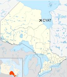
Location in Ontario
|
| Runways |
| Direction |
Length |
Surface |
| ft |
m |
06/24 |
3,495 |
1,065 |
Gravel |
|
Facilities
A small building at the airport housing the airport offices. There are no hangars, and aircraft are parked in the apron area off the runway. Limited parking is located next to the airport building.
Airlines and destinations
| Airlines |
Destinations |
| Air Creebec |
Fort Albany, Kashechewan, Moosonee, Peawanuck, Timmins |
| Thunder Airlines |
Fort Albany, Kashechewan, Moosonee, Peawanuck, Timmins |
Note: Other private small airplanes/airlines (e.g. Wabusk Air, Bushland Airways Ltd., Wasaya Airways) provide services or cargo to Attawapiskat and other locations only. Air Creebec offers fixed wing air ambulance transfer to Ontario or Quebec. Thunder Air is an air ambulance contractor with ORNGE.
The above content comes from Wikipedia and is published under free licenses – click here to read more.
The content above was published at Airports-Worldwide.com in 2018.
We don't guarantee the information is fresh and accurate. The data may
be wrong or outdated.
For more up-to-date information please refer to other sources.
|
|


