Angling Lake/Wapekeka Airport |
Angling Lake/Wapekeka Airport, (IATA: YAX, TC LID: CKB6), is located 1.5 nautical miles (2.8 km; 1.7 mi) west of the First Nations settlement of Wapekeka, Ontario, Canada, to the east of Big Trout Lake and on the south shores of Weir Lake.
The airport is operated by the Government of Ontario, and consists of a gravel runway with published instrument approaches. A gravel road connects to nearby community of Angling Lake.
| Angling Lake/Wapekeka Airport |
- IATA: YAX
- ICAO: none
- TC LID: CKB6
|
| Summary |
| Airport type |
Public |
| Operator |
Government of Ontario |
| Location |
Wapekeka First Nation |
| Time zone |
CST (UTC−06:00) |
| Summer (DST) |
CDT (UTC−05:00) |
| Elevation AMSL |
712 ft / 217 m |
| Coordinates |
53°50′57″N
089°34′46″W |
| Map |
|
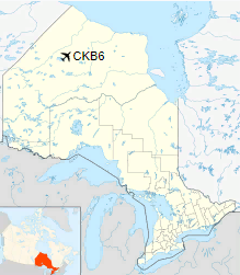
Location in Ontario
|
| Runways |
| Direction |
Length |
Surface |
| ft |
m |
12/30 |
3,609 |
1,100 |
Gravel |
|
|
Source: Canada Flight Supplement |
History
Angling lake airport was asked by the then band Chief in 1988 and it opened in 1989.
The above content comes from Wikipedia and is published under free licenses – click here to read more.
The content above was published at Airports-Worldwide.com in 2018.
We don't guarantee the information is fresh and accurate. The data may
be wrong or outdated.
For more up-to-date information please refer to other sources.
|


