|
Edmundston Airport (ICAO: CYES) is located 9 nautical miles (17 km; 10 mi) northwest of Edmundston, New Brunswick, Canada along the east bank of the Madawaska River.
The airport is unique among Canadian airports in that its runway straddles the interprovincial border between New Brunswick and Quebec and is located in Patrieville, New Brunswick in Madawaska County and Dégelis, Quebec in the Témiscouata Regional County Municipality.
The airport is classified as an airport of entry by Nav Canada and is staffed by the Canada Border Services Agency (CBSA). CBSA officers at this airport can handle general aviation aircraft only, with no more than 15 passengers.
The airport featured a World War II-era Lancaster KB882 on display outside the terminal building since 1964. The aircraft was relocated in 2017, to the National Air Force Museum of Canada.
|
Edmundston Airport |
- IATA: none
- ICAO: CYES
- WMO: 71590
|
| Summary |
| Airport type |
Public |
| Operator |
Aéroport Madawaska Airport Inc |
| Location |
Edmundston, New Brunswick |
| Time zone |
AST (UTC−04:00) |
| • Summer (DST) |
ADT (UTC−03:00) |
| Elevation AMSL |
498 ft / 152 m |
| Coordinates |
47°29′24″N
068°28′54″W |
| Map |
|
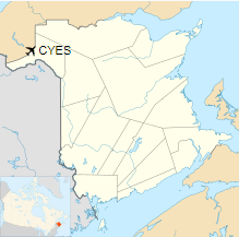
Location in New Brunswick
|
| Runways |
| Direction |
Length |
Surface |
| ft |
m |
16/34 |
4,562 |
1,390 |
Asphalt |
|
|
Sources: Canada Flight Supplement
Environment Canada |
The above content comes from Wikipedia and is published under free licenses – click here to read more.
| General Info
|
| Country |
Canada
|
| ICAO ID |
CYES
|
| Latitude |
47.490555
47° 29' 26.00" N
|
| Longitude |
-68.481944
068° 28' 55.00" W
|
| Elevation |
490 feet
149 meters
|
| Magnetic Variation |
018° W (01/06)
|
| Beacon |
Yes
|
| Operating Agency |
PRIVATE
|
| Daylight Saving Time |
Second Sunday in March at 0200 to first Sunday in November at 0200 local time (Exception Arizona and that portion of Indiana in the Eastern Time Zone)
|
| Communications
|
| CTAF/UNICOM |
122.8
|
| Runways
|
ID
|
Dimensions |
Surface |
PCN |
ILS
|
| 16/34 |
4499 x 75 feet
1371 x 23 meters |
ASPHALT |
- |
NO
|
| Supplies/Equipment
|
| Fuel |
100/130 MIL Spec, low lead, aviation gasoline (BLUE)
|
The content above was published at Airports-Worldwide.com in 2019.
We don't guarantee the information is fresh and accurate. The data may
be wrong or outdated.
For more up-to-date information please refer to other sources.
|


