 |
|
The Pas Airport, (IATA: YQD, ICAO: CYQD), is located 10 nautical miles (19 km; 12 mi) northeast of The Pas, Manitoba, Canada.
| The Pas Airport |
- IATA: YQD
- ICAO: CYQD
- WMO: 71867
|
| Summary |
| Airport type |
Public |
| Operator |
Town of The Pas |
| Location |
The Pas, Manitoba |
| Time zone |
CST (UTC−06:00) |
| Summer (DST) |
CDT (UTC−05:00) |
| Elevation AMSL |
888 ft / 271 m |
| Coordinates |
53°58′17″N
101°05′28″W |
| Map |
|
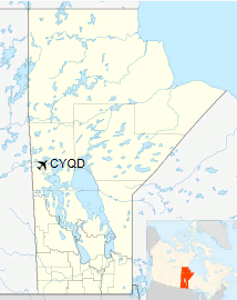
Location in Manitoba
|
| Runways |
| Direction |
Length |
Surface |
| ft |
m |
13/31 |
5,901 |
1,799 |
Asphalt |
|
| Statistics (2010) |
|
|
|
Source: Canada Flight Supplement
Environment Canada
Movements from Statistics Canada. |
RCAF Aerodrome The Pas
In approximately 1942 the aerodrome was listed at 53°58′N 101°06′W 53.967°N 101.100°W< / 53.967; -101.100 with a Var. 17 degrees E and no elevation data. 3 runways were listed as follows:
| Runway Name |
Length |
Width |
Surface |
| 2/20 |
6000' |
200' |
Hard (asphalt) surfaced |
| 12/30 |
4000' |
200' |
Hard (asphalt) surfaced |
| 7/25 |
6300' |
200' |
Hard (asphalt) surfaced |
The runways are listed as under construction, Servicable.
Airlines and destinations
| Airlines |
Destinations |
| Calm Air |
Flin Flon, Thompson, Winnipeg |
| Missinippi Air |
Flin Flon, Saskatoon |
The above content comes from Wikipedia and is published under free licenses – click here to read more.
| General Info
|
| Country |
Canada
|
| ICAO ID |
CYQD
|
| Latitude |
53.971389
53° 58' 17.00" N
|
| Longitude |
-101.091111
101° 05' 28.00" W
|
| Elevation |
887 feet
270 meters
|
| Type |
Civil
|
| Magnetic Variation |
007° E (01/06)
|
| Beacon |
Yes
|
| Operating Agency |
MUNICIPAL
|
| Daylight Saving Time |
Second Sunday in March at 0200 to first Sunday in November at 0200 local time (Exception Arizona and that portion of Indiana in the Eastern Time Zone)
|
| Communications
|
| WINNIPEG RDO |
122.2
126.7
|
| WINNIPEG CNTR |
135.625
|
MF WINNIPEG RDO
Opr 1300-0500Z++
|
122.2
|
| Runways
|
ID
|
Dimensions |
Surface |
PCN |
ILS
|
| 13/31 |
5900 x 150 feet
1798 x 46 meters |
ASPHALT |
054FCWT |
NO
|
| Navaids
|
| Type |
ID |
Name |
Channel |
Freq |
Distance From Field |
Bearing From Navaid
|
| VOR-DME |
YQD |
THE PAS |
083X |
113.6 |
At Field |
-
|
| NDB |
QD |
THE PAS |
- |
284 |
At Field |
-
|
| Supplies/Equipment
|
| Fuel |
Jet B, Wide cut turbine fuel, Without icing inhibitor.
100/130 MIL Spec, low lead, aviation gasoline (BLUE)
|
The content above was published at Airports-Worldwide.com in 2019.
We don't guarantee the information is fresh and accurate. The data may be wrong or outdated.
For more up-to-date information please refer to other sources.
|
|


