 |
|
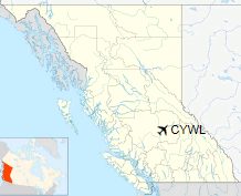
Williams Lake Airport or Williams Lake Regional Airport, (IATA: YWL, ICAO: CYWL), is located 4.2 nautical miles (7.8 km; 4.8 mi) northeast of Williams Lake, British Columbia, Canada.
| Williams Lake Airport |
- IATA: YWL
- ICAO: CYWL
- WMO: 71104
|
| Summary |
| Airport type |
Public |
| Operator |
City of Williams Lake |
| Location |
Williams Lake, British Columbia |
| Time zone |
PST (UTC-08:00) |
| Summer (DST) |
PDT (UTC-07:00) |
| Elevation AMSL |
3,083 ft / 940 m |
| Coordinates |
52°11′00″N
122°03′16″W |
| Website |
www.williamslake.ca |
| Map |
|
Location in British Columbia
|
| Runways |
| Direction |
Length |
Surface |
| ft |
m |
11/29 |
7,000 |
2,134 |
Asphalt |
|
| Statistics (2010) |
| Aircraft movements |
13,854 |
|
|
Sources: Canada Flight Supplement
Environment Canada
Movements from Statistics Canada |
Airlines and destinations
| Airlines |
Destinations |
| Pacific Coastal Airlines |
Vancouver |
| Carson Air |
Vancouver, Kelowna'"MedEvac Only"' |
| Central Mountain Air |
Vancouver |
| North Cariboo Air |
Charter: Vancouver |
| Northern Thunderbird Air |
Vancouver |
The above content comes from Wikipedia and is published under free licenses – click here to read more.
| General Info
|
| Country |
Canada
|
| ICAO ID |
CYWL
|
| Latitude |
52.183056
52° 10' 59.00" N
|
| Longitude |
-122.054167
122° 03' 15.00" W
|
| Elevation |
3085 feet
940 meters
|
| Type |
Civil
|
| Magnetic Variation |
019° E (01/06)
|
| Beacon |
Yes
|
| Operating Agency |
MUNICIPAL
|
| Daylight Saving Time |
Second Sunday in March at 0200 to first Sunday in November at 0200 local time (Exception Arizona and that portion of Indiana in the Eastern Time Zone)
|
| Communications
|
| RDO |
122.3
|
| PACIFIC RDO |
126.7
|
| VDF |
122.3
|
| VANCOUVER CNTR |
134.0
381.4
|
| MF WILLIAMS LAKE RDO |
122.3
|
| Communications Remarks |
|
| RDO |
(Emerg only C250-989-4415)
|
| RCO |
(KAMLOOPS FSS)
|
| Runways
|
ID
|
Dimensions |
Surface |
PCN |
ILS
|
| 11/29 |
7000 x 150 feet
2134 x 46 meters |
ASPHALT |
070FCWT |
NO
|
| Navaids
|
| Type |
ID |
Name |
Channel |
Freq |
Distance From Field |
Bearing From Navaid
|
| VORTAC |
YWL |
WILLIAMS LAKE |
083X |
113.6 |
5.4 NM |
105.9
|
| NDB |
WL |
WILLIAMS LAKE |
- |
385 |
4.1 NM |
292.1
|
| Supplies/Equipment
|
| Fuel |
Jet B, Wide cut turbine fuel, Without icing inhibitor.
100/130 MIL Spec, low lead, aviation gasoline (BLUE)
|
The content above was published at Airports-Worldwide.com in 2018.
We don't guarantee the information is fresh and accurate. The data may
be wrong or outdated.
For more up-to-date information please refer to other sources.
|
|


