 |
|
West Kootenay Regional Airport (Castlegar Airport) |
|
|
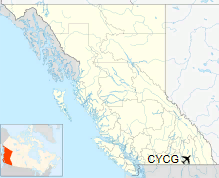
The West Kootenay Regional Airport, (Castlegar Airport) (IATA: YCG, ICAO: CYCG) is a small regional airport located 2 nautical miles (3.7 km; 2.3 mi) south southeast of Castlegar, British Columbia, Canada. It serves the West Kootenay region, including Castlegar, Nelson and Trail. It is owned and operated by the City of Castlegar, and has a 15,317 sq ft (1,423 m2) passenger terminal. Due to the mountainous terrain impinging on both runway approaches, there is no possibility of a straight-in approach. The airport is therefore certified for day operations only, and the glideslope on approach is set to a steep 5.0° rather than the standard 3.0°. The instrument approaches to Castlegar are considered among the most challenging of any in use at a commercial airport in North America. As of 2017, the Dash-8s serving the airport required minimums of 2874 foot cloud ceilings and three miles visibility (Air Canada Jazz adds 100 feet to these minimums).
|
West Kootenay Regional Airport (Castlegar Airport). |
In 2006, Castlegar airport was developing departure procedures for night time operation, but as of 2010 the airport was certified for daytime operation only. A $1 million programme installed six beacons on the hills of the Columbia Valley that allow night-time take offs from the airport. It is expected this will only be used by air ambulances and medical traffic.
|
West Kootenay Regional Airport (Castlegar Airport). |
The airport is classified as an airport of entry by Nav Canada and is staffed by the Canada Border Services Agency (CBSA). The customs at CBSA officers at this airport can handle general aviation aircraft only, with no more than 15 passengers.
|
West Kootenay Regional Airport
Castlegar/West Kootenay Regional Airport |
|
|
| Summary |
| Airport type |
Public |
| Owner/Operator |
City of Castlegar |
| Location |
Castlegar, British Columbia |
| Time zone |
PST (UTC-08:00) |
| Summer (DST) |
PDT (UTC-07:00) |
| Elevation AMSL |
1,626 ft / 496 m |
| Coordinates |
49°17′46″N
117°37′57″W |
| Website |
www.castlegar.ca/airport.php |
| Map |
|
Location in British Columbia
|
| Runways |
| Direction |
Length |
Surface |
| ft |
m |
15/33 |
5,299 |
1,615 |
Asphalt |
|
| Statistics (2010) |
| Aircraft movements |
12,437 |
|
|
Sources: Canada Flight Supplement and Transport Canada
Movements from Statistics Canada |
|
West Kootenay Regional Airport (Castlegar Airport). |
Airlines
| Airlines |
Destinations |
| Air Canada Express |
Calgary, Vancouver |
|
West Kootenay Regional Airport (Castlegar Airport). |
The above content comes from Wikipedia and is published under free licenses – click here to read more.
| General Info
|
| Country |
Canada
|
| ICAO ID |
CYCG
|
| Time |
UTC-8(-7DT)
|
| Latitude |
49.296389
49° 17' 47.00" N
|
| Longitude |
-117.632500
117° 37' 57.00" W
|
| Elevation |
1624 feet
495 meters
|
| Type |
Civil
|
| Magnetic Variation |
017° E (01/06)
|
| Beacon |
Yes
|
| Operating Agency |
CIVIL GOVERNMENT, (LANDING FEES AND DIPLOMATIC CLEARANCE MAY BE REQUIRED)
|
| Operating Hours |
24 HOUR OPERATIONS
|
| International Clearance Status |
Airport of Entry
|
| Daylight Saving Time |
Second Sunday in March at 0200 to first Sunday in November at 0200 local time (Exception Arizona and that portion of Indiana in the Eastern Time Zone)
|
| Communications
|
RDO
Opr 1330-0130Z++.
|
122.1
|
| KAMLOOPS RDO |
126.7
|
CTAF
Opr 1330-0130Z++.
|
122.1
|
| VANCOUVER CNTR |
134.2
227.3
|
| Communications Remarks |
|
| RDO |
Emerg only C250-365-3013.
|
| RCO |
(RCO)
|
| CNTR |
(APP DEP svc)
|
| Runways
|
ID
|
Dimensions |
Surface |
PCN |
ILS
|
| 15/33 |
5300 x 150 feet
1615 x 46 meters |
ASPHALT |
067FAWT |
NO
|
| Navaids
|
| Type |
ID |
Name |
Channel |
Freq |
Distance From Field |
Bearing From Navaid
|
| NDB |
YK |
BRILLIANT |
- |
269 |
1.7 NM |
158.1
|
| DME |
XCG |
CASTLEGAR |
038X |
- |
2.9 NM |
006.3
|
| Supplies/Equipment
|
| Fuel |
Jet B, Wide cut turbine fuel, Without icing inhibitor.
100/130 MIL Spec, low lead, aviation gasoline (BLUE)
|
| Remarks
|
| CAUTION |
Mt sur arpt. P-line 40' AGL crosses apch to Rwy 33 aprx 1500' fr thld.
|
| FUEL |
(NC-100LL, B)
|
| LGT |
PAPI Rwy 33 offset 12 left. PAPI Rwy 15-33 lgt unit for acft with eye-to-wheel hgt up to 25'. PAPI Rwy 15 obst clnc ltd to 3 NM. PAPI Rwy 33 obst clnc ltd to 2NM.
|
| RSTD |
Twy B rstd to acft under 50,000 lb.
|
| TFC PAT |
Rgt tfc Rwy 15.
|
The content above was published at Airports-Worldwide.com in 2018.
We don't guarantee the information is fresh and accurate. The data may
be wrong or outdated.
For more up-to-date information please refer to other sources.
|
|


")
")
")
")