 |
|
Revelstoke Airport, (IATA: YRV, ICAO: CYRV), is located 1.7 nautical miles (3.1 km; 2.0 mi) south southeast of Revelstoke, British Columbia, Canada.
| Revelstoke Airport |
- IATA: YRV
- ICAO: CYRV
- WMO: 71882
|
| Summary |
| Airport type |
Public |
| Operator |
Columbia-Shuswap Regional District |
| Location |
Revelstoke, British Columbia |
| Time zone |
PST (UTC-08:00) |
| Summer (DST) |
PDT (UTC-07:00) |
| Elevation AMSL |
1,457 ft / 444 m |
| Coordinates |
50°57′44″N
118°11′04″W |
| Website |
Revelstoke Airport |
| Map |
|
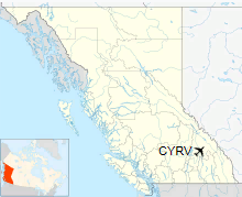
Location in British Columbia
|
| Runways |
| Direction |
Length |
Surface |
| ft |
m |
12/30 |
5,155 |
1,571 |
Asphalt |
|
|
Source: Canada Flight Supplement
Environment Canada |
Expansion plan
On December 7, 2011, the Columbia-Shuswap Regional District (CRSD) announced an expansion plan for the airport. While some parts of the plan are still preliminary and tentatively scheduled to take place over the course of the next few years, such as the extension of the runway, some other improvements in the Revelstoke Airport expansion include the upgrading of the terminal building and improving the airport's navigational systems. A 110m (355ft) runway extension was undertaken in 2014.
If the expansion of the airport were to take place, the projected cost would be about $765,000. $365,000 would come from the city's Resort Municipality Initiative funding, with the other $400,000 coming from the CSRD, although the latter funds would require the approval from the CSRD board.
The plan is to attract regular charters to bring tourists to Revelstoke and eventually develop the airport to implement regular commercial flights from other cities.
In the 2016/2017 ski season, Pacific Coastal Airlines will be operating a scheduled charter flight service to the airport for ski travelers.
Airlines and destinations
| Airlines |
Destinations |
| Pacific Coastal Airlines |
Seasonal Charter: Vancouver |
The above content comes from Wikipedia and is published under free licenses – click here to read more.
| General Info
|
| Country |
Canada
|
| ICAO ID |
CYRV
|
| Latitude |
50.966667
50° 58' 00.00" N
|
| Longitude |
-118.183333
118° 11' 00.00" W
|
| Elevation |
1459 feet
445 meters
|
| Magnetic Variation |
017° E (01/06)
|
| Operating Agency |
MUNICIPAL
|
| Daylight Saving Time |
Second Sunday in March at 0200 to first Sunday in November at 0200 local time (Exception Arizona and that portion of Indiana in the Eastern Time Zone)
|
| Communications
|
| CTAF/UNICOM |
122.8
|
| PACIFIC RDO |
126.7
|
| Communications Remarks |
|
| RCO |
(KAMLOOPS FSS)
|
| Runways
|
ID
|
Dimensions |
Surface |
PCN |
ILS
|
| 12/30 |
4800 x 75 feet
1463 x 23 meters |
ASPHALT |
- |
NO
|
| Supplies/Equipment
|
| Fuel |
Jet B, Wide cut turbine fuel, Without icing inhibitor.
100/130 MIL Spec, low lead, aviation gasoline (BLUE)
|
The content above was published at Airports-Worldwide.com in 2018.
We don't guarantee the information is fresh and accurate. The data may
be wrong or outdated.
For more up-to-date information please refer to other sources.
|
|


