 |
|
Prince Rupert Airport (IATA: YPR, ICAO: CYPR) is an airport located 5.0 nautical miles (9.3 km; 5.8 mi) west southwest of Prince Rupert, British Columbia, Canada.
The airport is classified as an airport of entry by Nav Canada and is staffed by the Canada Border Services Agency (CBSA). CBSA officers at this airport can handle general aviation aircraft only, with no more than 50 passengers.
The airport is located on Digby Island which is only accessible from the city of Prince Rupert by ferry. The passenger ferry fare is included in airline tickets.
| Prince Rupert Airport |
- IATA: YPR
- ICAO: CYPR
- WMO: 71022
|
| Summary |
| Airport type |
Public |
| Operator |
Prince Rupert Airport Authority |
| Location |
Prince Rupert, British Columbia |
| Time zone |
PST (UTC-08:00) |
| Summer (DST) |
PDT (UTC-07:00) |
| Elevation AMSL |
116 ft / 35 m |
| Coordinates |
54°17′09″N
130°26′41″W |
| Website |
www.YPR.ca |
| Map |
|
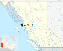
Location in British Columbia
|
| Runways |
| Direction |
Length |
Surface |
| ft |
m |
13/31 |
6,000 |
1,829 |
Asphalt |
|
| Statistics (2013) |
| Aircraft movements |
2,164 |
| Passengers |
60,914 |
|
|
Sources: Canada Flight Supplement
Environment Canada
Statistics from Prince Rupert Airport Authority |
Airlines and destinations
| Airlines |
Destinations |
| Air Canada Express |
Vancouver |
| Northern Thunderbird Air |
Charter: Vancouver |
Air Cargo Carriers and Destinations
| Airlines |
Destinations |
| SkyLink Express |
Vancouver Air Cargo Charters |
The above content comes from Wikipedia and is published under free licenses – click here to read more.
| General Info
|
| Country |
Canada
|
| ICAO ID |
CYPR
|
| Latitude |
54.286110
54° 17' 10.00" N
|
| Longitude |
-130.444722
130° 26' 41.00" W
|
| Elevation |
116 feet
35 meters
|
| Type |
Civil
|
| Magnetic Variation |
021° E (01/06)
|
| Beacon |
Yes
|
| Operating Agency |
MUNICIPAL
|
| Alternate Name |
DIGBY ISLAND
|
| Daylight Saving Time |
Second Sunday in March at 0200 to first Sunday in November at 0200 local time (Exception Arizona and that portion of Indiana in the Eastern Time Zone)
|
| Communications
|
| PACIFIC RDO |
126.7
|
TERRACE RDO
Opr 0600-1400Z++ |
122.5
|
| VANCOUVER CNTR |
128.0
284.0
|
RUPERT RDO
Opr 1400-0600Z++ OT TERRACE RDO |
122.5
|
| Communications Remarks |
|
| RCO |
(Emergency Only C250-627-5384)
|
| Runways
|
ID
|
Dimensions |
Surface |
PCN |
ILS
|
| 13/31 |
6000 x 200 feet
1829 x 61 meters |
ASPHALT |
067FAWT |
NO
|
| Navaids
|
| Type |
ID |
Name |
Channel |
Freq |
Distance From Field |
Bearing From Navaid
|
| NDB |
PR |
PRINCE RUPERT |
- |
218 |
1.6 NM |
308.7
|
| DME |
IPR |
PRINCE RUPERT |
034X |
- |
At Field |
-
|
| Supplies/Equipment
|
| Fuel |
Jet A, without icing inhibitor.
100/130 octane gasoline, leaded, MIL-L-5572F (GREEN)
|
The content above was published at Airports-Worldwide.com in 2018.
We don't guarantee the information is fresh and accurate. The data may
be wrong or outdated.
For more up-to-date information please refer to other sources.
|
|


