 |
|
Hudson's Hope Airport, (IATA: YNH, ICAO: CYNH), is located 3 nautical miles (5.6 km; 3.5 mi) west northwest of Hudson's Hope, British Columbia, Canada.
| Hudson's Hope Airport |
|
|
| Summary |
| Airport type |
Public |
| Operator |
District of Hudson's Hope |
| Location |
Hudson's Hope, British Columbia |
| Time zone |
MST (UTC-07:00) |
| Elevation AMSL |
2,220 ft / 677 m |
| Coordinates |
56°02′08″N
121°58′33″W |
| Map |
|
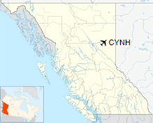
Location in British Columbia
|
| Runways |
| Direction |
Length |
Surface |
| ft |
m |
05/23 |
5,200 |
1,585 |
Asphalt |
|
|
Source: Canada Flight Supplement |
The above content comes from Wikipedia and is published under free licenses – click here to read more.
| General Info
|
| Country |
Canada
|
| ICAO ID |
CYNH
|
| Latitude |
56.035556
56° 02' 08.00" N
|
| Longitude |
-121.975833
121° 58' 33.00" W
|
| Elevation |
2220 feet
677 meters
|
| Magnetic Variation |
021° E (01/06)
|
| Operating Agency |
MUNICIPAL
|
| Daylight Saving Time |
Second Sunday in March at 0200 to first Sunday in November at 0200 local time (Exception Arizona and that portion of Indiana in the Eastern Time Zone)
|
| Communications
|
| CTAF |
123.2
|
| Runways
|
ID
|
Dimensions |
Surface |
PCN |
ILS
|
| 05/23 |
5200 x 100 feet
1585 x 30 meters |
ASPHALT |
- |
NO
|
The content above was published at Airports-Worldwide.com in 2018.
We don't guarantee the information is fresh and accurate. The data may
be wrong or outdated.
For more up-to-date information please refer to other sources.
|
|


