|
Hope Aerodrome, (IATA: YHE, ICAO: CYHE), is located 2.6 nautical miles (4.8 km; 3.0 mi) west of Hope Townsite(the previous Town of Hope) within the municipal District of Hope, British Columbia, Canada.
This airfield is home to the Vancouver Soaring Association, a gliding club owning and operating seven school and recreational sailplanes and two Cessna L-19 Bird Dog as tow planes.
There is one turf runway 3,960 ft x 250 ft (1,207 m x 76 m). The airport is operated by the Fraser Valley Regional District. The Hope Airport lies within the community of Flood in the District of Hope.
Hope is notable as being the location of a Boeing demonstration of the Boeing 737's landing and take off abilities in 1972.
| Hope Aerodrome |
- IATA: YHE
- ICAO: CYHE
- WMO: 71114
|
| Summary |
| Airport type |
Public |
| Operator |
Fraser Valley Regional District |
| Location |
Hope, British Columbia |
| Time zone |
PST (UTC-08:00) |
| Summer (DST) |
PDT (UTC-07:00) |
| Elevation AMSL |
128 ft / 39 m |
| Coordinates |
49°22′06″N
121°29′53″W |
| Map |
|
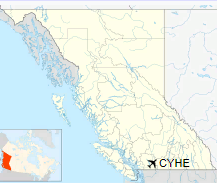
Location in British Columbia
|
| Runways |
| Direction |
Length |
Surface |
| ft |
m |
07/25 |
3,960 |
1,207 |
Turf |
|
|
Source: Canada Flight Supplement
Environment Canada |
The above content comes from Wikipedia and is published under free licenses – click here to read more.
The content above was published at Airports-Worldwide.com in 2018.
We don't guarantee the information is fresh and accurate. The data may
be wrong or outdated.
For more up-to-date information please refer to other sources.
|


