 |
|
Dawson Creek (Flying L Ranch) Airport |
Dawson Creek (Flying L Ranch) Airport, (TC LID: CDC3), is located 7.5 nautical miles (13.9 km; 8.6 mi) northwest of Dawson Creek, British Columbia, Canada.
| Dawson Creek (Flying L Ranch) Airport< |
- IATA: none
- ICAO: none
- TC LID: CDC3
|
| Summary |
| Airport type |
Private |
| Operator |
Flying L Ranch |
| Location |
Dawson Creek, British Columbia |
| Time zone |
MST (UTC-07:00) |
| Elevation AMSL |
2,680 ft / 817 m |
| Coordinates |
55°49′14″N
120°27′10″W |
| Map |
|
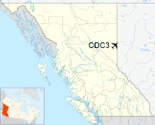
Location in British Columbia
|
| Runways |
| Direction |
Length |
Surface |
| ft |
m |
07/25 |
2,000 |
610 |
Turf |
|
|
Source: Canada Flight Supplement |
The above content comes from Wikipedia and is published under free licenses – click here to read more.
The content above was published at Airports-Worldwide.com in 2018.
We don't guarantee the information is fresh and accurate. The data may
be wrong or outdated.
For more up-to-date information please refer to other sources.
|
|


