 |
|
Burns Lake Airport, (IATA: YPZ, ICAO: CYPZ), is located 11 nautical miles (20 km; 13 mi) northwest of Burns Lake, British Columbia, Canada.
| Burns Lake Airport |
|
|
| Summary |
| Airport type |
Public |
| Operator |
Airport Society |
| Location |
Burns Lake, British Columbia |
| Time zone |
PST (UTC-08:00) |
| Summer (DST) |
PDT (UTC-07:00) |
| Elevation AMSL |
2,343 ft / 714 m |
| Coordinates |
54°22′35″N
125°57′05″W |
| Map |
|
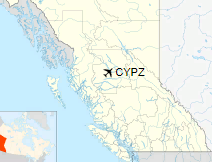
Location in British Columbia
|
| Runways |
| Direction |
Length |
Surface |
| ft |
m |
11/29 |
5,060 |
1,542 |
Asphalt |
|
|
Source: Canada Flight Supplement |
The above content comes from Wikipedia and is published under free licenses – click here to read more.
| General Info
|
| Country |
Canada
|
| ICAO ID |
CYPZ
|
| Latitude |
54.376389
54° 22' 35.00" N
|
| Longitude |
-125.951389
125° 57' 05.00" W
|
| Elevation |
2343 feet
714 meters
|
| Magnetic Variation |
021° E (01/06)
|
| Operating Agency |
MUNICIPAL
|
| Daylight Saving Time |
Second Sunday in March at 0200 to first Sunday in November at 0200 local time (Exception Arizona and that portion of Indiana in the Eastern Time Zone)
|
| Communications
|
| PACIFIC RDO |
126.7
|
| LWIS |
122.95
|
| CTAF |
122.7
|
| VANCOUVER CNTR |
128.8
|
| Communications Remarks |
|
| MISC |
C250-698-7732.
|
| Runways
|
| ID |
Dimensions |
Surface |
PCN |
ILS
|
| 11/29 |
5000 x 75 feet
1524 x 23 meters |
ASPHALT |
- |
NO
|
The content above was published at Airports-Worldwide.com in 2018.
We don't guarantee the information is fresh and accurate. The data may
be wrong or outdated.
For more up-to-date information please refer to other sources.
|
|


