 |
|
Beaverley Aerodrome (TC LID: CBA8) is located 2.5 nautical miles (4.6 km; 2.9 mi) north of Beaverley, British Columbia, Canada and 4 NM (7.4 km; 4.6 mi) west of the City of Prince George. The aerodrome is home to the Black Ram Parachute School.
| Beaverley Airport |
- IATA: none
- ICAO: none
- TC LID: CBA8
|
| Summary |
| Airport type |
Public |
| Operator |
Cyr's Recreational Aviation Park |
| Location |
Beaverley, British Columbia |
| Time zone |
PST (UTC-08:00) |
| Summer (DST) |
PDT (UTC-07:00) |
| Elevation AMSL |
2,420 ft / 738 m |
| Coordinates |
53°51′20″N
122°54′27″W |
| Map |
|
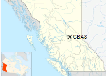
Location in British Columbia
|
| Runways |
| Direction |
Length |
Surface |
| ft |
m |
07/25 |
2,461 |
750 |
Gravel |
|
|
Source: Canada Flight Supplement |
The above content comes from Wikipedia and is published under free licenses – click here to read more.
The content above was published at Airports-Worldwide.com in 2018.
We don't guarantee the information is fresh and accurate. The data may
be wrong or outdated.
For more up-to-date information please refer to other sources.
|
|


