 |
|
Vulcan/Kirkcaldy Aerodrome |
Vulcan/Kirkcaldy Aerodrome, (TC LID: CVL2), is located 5.7 nautical miles (10.6 km; 6.6 mi) southwest of Vulcan, Alberta, Canada. The airport, which was reopened in 2011, was originally RCAF Station Vulcan as part of the British Commonwealth Air Training Plan during the Second World War.
| Vulcan/Kirkcaldy Aerodrome |
- IATA: none
- ICAO: none
- TC LID: CVL2
|
| Summary |
| Airport type |
Private |
| Operator |
Wheatland Industries Ltd. |
| Location |
Vulcan, Alberta |
| Time zone |
MST (UTC−07:00) |
| Summer (DST) |
MDT (UTC−06:00) |
| Elevation AMSL |
3,418 ft / 1,042 m |
| Coordinates |
50°19′55″N
113°21′28″W |
| Map |
|
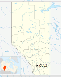
Location in Alberta
|
| Runways |
| Direction |
Length |
Surface |
| ft |
m |
03/21 |
3,187 |
971 |
Asphalt |
09/27 |
2,998 |
914 |
Asphalt |
15/33 |
3,076 |
938 |
Gravel |
|
The above content comes from Wikipedia and is published under free licenses – click here to read more.
The content above was published at Airports-Worldwide.com in 2018.
We don't guarantee the information is fresh and accurate. The data may
be wrong or outdated.
For more up-to-date information please refer to other sources.
|
|


