|
|
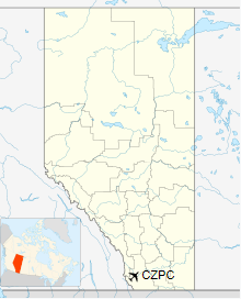
Pincher Creek Airport, (IATA: WPC, ICAO: CZPC), is located 3.0 nautical miles (5.6 km; 3.5 mi) northwest of Pincher Creek, Alberta, Canada.
| Pincher Creek Airport |
|
|
| Summary |
| Airport type |
Public |
| Operator |
Municipal District of Pincher Creek |
| Location |
Municipal District of Pincher Creek No. 9, near Pincher Creek, Alberta |
| Time zone |
MST (UTC-07:00) |
| Summer (DST) |
MDT (UTC-06:00) |
| Elevation AMSL |
3,903 ft / 1,190 m |
| Coordinates |
49°31'14″N
113°59'50″W |
| Map |
|
|
| Runways |
| Direction |
Length |
Surface |
| ft |
m |
| 07/25 |
6,597 |
2,011 |
Asphalt |
|
The above content comes from Wikipedia and is published under free licenses – click here to read more.
| General
Info
|
| Country |
Canada
|
| ICAO
ID |
CZPC
|
| Time |
UTC-7(-6DT)
|
| Latitude |
49.520556
49° 31' 14.00" N
|
| Longitude |
-113.997222
113° 59' 50.00" W
|
| Elevation |
3903
feet
1190 meters
|
| Magnetic
Variation |
015°
E (01/06)
|
| Beacon |
Yes
|
| Operating
Agency |
CIVIL
GOVERNMENT, (LANDING FEES AND DIPLOMATIC CLEARANCE MAY BE REQUIRED)
|
| Daylight
Saving Time |
Second
Sunday in March at 0200 to first Sunday in November at 0200 local
time (Exception Arizona and that portion of Indiana in the Eastern
Time Zone) |
| Communications
|
| EDMONTON
RDO |
126.7
|
| CTAF |
123.2
|
| EDMONTON
CNTR |
132.75
265.2 |
| Runways
|
| ID |
Dimensions |
Surface |
PCN |
ILS
|
| 07/25
|
6600
x 100 feet
2012 x 30 meters |
ASPHALT |
- |
NO
|
| Navaids
|
| Type |
ID |
Name |
Channel |
Freq |
Distance
From Field |
Bearing
From Navaid
|
| NDB |
9Y |
PINCHER
CREEK |
- |
311 |
At
Field |
-
|
| Supplies/Equipment
|
| Fuel |
100/130
octane gasoline, leaded, MIL-L-5572F (GREEN)
80/87 octane gasoline, leaded, MIL-L-5572F (RED) |
| Remarks
|
| CAUTION |
Acft
on rwy not vis fr all areas. Water bomber act in vcnty of aprt Apr-Sep.
|
| FUEL |
(NC-100,A)
|
| LGT |
VASI
Rwy 07-25 lgt unit for acft with eye-to-wheel hgt up to 10'. ACTIVATE-MIRL
Rwy 07-25 and PAPI Rwy 07-25-CTAF. |
The content above was published at Airports-Worldwide.com in 2018.
We don't guarantee the information is fresh and accurate. The data may be wrong or outdated.
For more up-to-date information please refer to other sources.
|
|