|
|
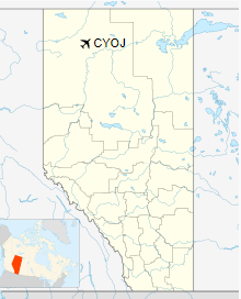
High Level Airport, (IATA: YOJ, ICAO: CYOJ), is located 6 nautical miles (11 km; 6.9 mi) north northwest of High Level, Alberta, Canada. National Car Rental have an office onsite.
| High Level Airport |
- IATA: YOJ
- ICAO: CYOJ
- WMO: 71066
|
| Summary |
| Airport type |
Public |
| Operator |
Town of High Level |
| Location |
Mackenzie County, near High Level, Alberta |
| Time zone |
MST (UTC-07:00) |
| Summer (DST) |
MDT (UTC-06:00) |
| Elevation AMSL |
1,109 ft / 338 m |
| Coordinates |
58°37'18″N 117°09'53″W |
| Map |
|
|
| Runways |
| Direction |
Length |
Surface |
| ft |
m |
| 13/31 |
5,002 |
1,525 |
Asphalt |
|
| Statistics (2010) |
| Aircraft movements |
13,279 |
|
Airlines and destinations
| Destinations |
| Central Mountain Air |
Edmonton |
| Northwestern Air |
Edmonton, Fort Smith, Hay River |
The above content comes from Wikipedia and is published under free licenses – click here to read more.
| General
Info
|
| Country |
Canada
|
| ICAO
ID |
CYOJ
|
| Latitude |
58.621389
58° 37' 17.00" N
|
| Longitude |
-117.164722
117° 09' 53.00" W
|
| Elevation |
1110
feet
338 meters
|
| Type |
Civil
|
| Magnetic
Variation |
020°
E (01/06)
|
| Beacon |
Yes
|
| Operating
Agency |
MUNICIPAL
|
| Alternate
Name |
FOOTNER
LAKE
|
| Daylight
Saving Time |
Second
Sunday in March at 0200 to first Sunday in November at 0200 local
time (Exception Arizona and that portion of Indiana in the Eastern
Time Zone) |
| Communications
|
| EDMONTON
RDO |
123.375
|
| RDO |
123.25
|
| EDMONTON
CNTR |
123.7
135.01
|
| MF
HIGH LEVEL RDO |
123.25
|
| Communications
Remarks |
|
| CNTR |
(Blw
FL290)
|
| FSS |
(Emerg
only C780-926-3606) |
| Runways
|
| ID |
Dimensions |
Surface |
PCN |
ILS
|
| 13/31
|
5000
x 150 feet
1524 x 46 meters |
ASPHALT |
- |
NO
|
| Navaids
|
| Type |
ID |
Name |
Channel |
Freq |
Distance
From Field |
Bearing
From Navaid
|
| VOR-DME |
YOJ |
HIGH
LEVEL |
080X |
113.3 |
4.6 NM |
307.2
|
| NDB |
OJ |
HIGH
LEVEL |
- |
239 |
4.3 NM |
341.4
|
| Supplies/Equipment
|
| Fuel |
Jet
B, Wide cut turbine fuel, Without icing inhibitor.
100/130 octane gasoline, leaded, MIL-L-5572F (GREEN) |
The content above was published at Airports-Worldwide.com in 2018.
We don't guarantee the information is fresh and accurate. The data may be wrong or outdated.
For more up-to-date information please refer to other sources.
|
|