Fort Macleod (Alcock Farm) Airport |
Fort Macleod Airport, (TC LID: CEY3), is located 1 nautical mile (1.9 km; 1.2 mi) southwest of Fort Macleod, Alberta, Canada.
| Fort Macleod Airport |
- IATA: none
- ICAO: none
- TC LID: CEY3
|
| Summary |
| Airport type |
Public |
| Operator |
Town of Fort Macleod |
| Location |
Fort Macleod, Alberta |
| Time zone |
MST (UTC-07:00) |
| Summer (DST) |
MDT (UTC-06:00) |
| Elevation AMSL |
3,138 ft / 956 m |
| Coordinates |
49°42′N
113°25′W |
| Map |
|
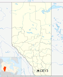
Location in Alberta
|
| Runways |
| Direction |
Length |
Surface |
| ft |
m |
06/24 |
3,000 |
914 |
Asphalt |
|
History
Fort Macleod Airport was originally RCAF Station Fort Macleod, a British Commonwealth Air Training Plan facility located near the west end of Fort MacLeod.
RCAF Station Fort Macleod had six runways in an overlaid triangle configuration. All of these runways were abandoned but can be seen clearly in aerial photography. Many wartime RCAF training stations had a triangle configuration in order to allow for takeoff and landing a wide range of wind directions. The modern runway 06/24 is not one of the original runways. It was an entirely new runway constructed approximately parallel to one of the existing runways but cutting across the other four near their apex.
The above content comes from Wikipedia and is published under free licenses – click here to read more.
The content above was published at Airports-Worldwide.com in 2018.
We don't guarantee the information is fresh and accurate. The data may
be wrong or outdated.
For more up-to-date information please refer to other sources.
|


