|
|
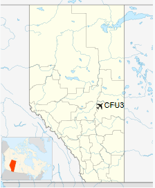
Chipman Airport, (TC LID: CFU3), is located 1.1 nautical miles (2.0 km; 1.3 mi) north of Chipman, Alberta, Canada.
The airport is owned and operated by the Edmonton Soaring Club. The Edmonton Soaring Club, which was previously operating from the Edmonton/Cooking Lake Airport, purchased the site in 1971, when other plans were being made for Cooking Lake by the Government of Alberta. This airport is also known as the «Chipman Gliderport».
Itinerant air traffic is welcome, and should use the aerodrome frequency of 123.4, and keep an eye out for glider traffic. The airport is not maintained in the winter, but is suitable for aircraft on skis when snow-covered. The airport is usually attended on weekends and designated flying weeks during the soaring season, which typically runs from mid-April through October.
Facilities available include a clubhouse with kitchen, bathrooms, showers; a bunkhouse for overnight accommodation; cable tie-downs; emergency fuel (100LL). Pilots should call ahead to see if the airport is attended (780) 363-3860.
| Chipman Airport |
- IATA: none
- ICAO: none
- TC LID: CFU3
|
| Summary |
| Airport type |
Public |
| Operator |
Edmonton Soaring Club |
| Location |
Lamont County, near Chipman, Alberta |
| Time zone |
MST (UTC−07:00) |
| • Summer (DST) |
MDT (UTC−06:00) |
| Elevation AMSL |
2,195 ft / 669 m |
| Coordinates |
53°43′N
112°38′W |
| Website |
www.edmontonsoaringclub.com |
| Map |
|
|
| Runways |
| Direction |
Length |
Surface |
| ft |
m |
| 10/28 |
2,600 |
792 |
Turf |
|
|
Chipman Airport. A Schweizer SGS 1-23D C-FXKL at the Edmonton Soaring Club in 1984. |
The above content comes from Wikipedia and is published under free licenses – click here to read more.
| General
Info
|
| Country |
Canada
|
| Latitude |
46.148611
46° 08' 55.00" N
|
| Longitude |
-65.904167
065° 54' 15.00" W
|
| Elevation |
65
feet
20 meters
|
| Magnetic
Variation |
019°
W (01/06)
|
| Operating
Agency |
PRIVATE
|
| Daylight
Saving Time |
Second
Sunday in March at 0200 to first Sunday in November at 0200 local
time (Exception Arizona and that portion of Indiana in the Eastern
Time Zone) |
| Communications
|
| CTAF |
123.2
|
| Runways
|
ID
|
Dimensions |
Surface |
PCN |
ILS
|
| 09/27
|
4022
x 50 feet
1226 x 15 meters |
ASPHALT |
- |
NO
|
The content above was published at Airports-Worldwide.com in 2018.
We don't guarantee the information is fresh and accurate. The data may be wrong or outdated.
For more up-to-date information please refer to other sources.
|
|