|
|
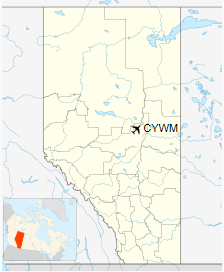
Athabasca Regional Airport, (ICAO: CYWM), is a registered aerodrome located 3.1 nautical miles (5.7 km; 3.6 mi) east northeast of Athabasca, Alberta, Canada. It serves private and commercial aircraft.
| Athabasca Regional Airport |
|
|
| Summary |
| Airport type |
Public |
| Operator |
Athabasca County |
| Location |
Athabasca County, near Athabasca, Alberta |
| Time zone |
MST (UTC−07:00) |
| • Summer (DST) |
MDT (UTC−06:00) |
| Elevation AMSL |
1,971 ft / 601 m |
| Coordinates |
54°44′35″N
113°12′19″W |
| Map |
|
|
| Runways |
| Direction |
Length |
Surface |
| ft |
m |
| 17/35 |
4,003 |
1,220 |
Asphalt |
|
Runway
The runway measures 4,000 ft × 100 ft (1,219 m × 30 m) and has an elevation of 1,971 ft (601 m) above MSL.
Other features of the runway include a Wide Area Augmentation System (WASS) that allows aircraft to descend to a minimum of 250 ft (76 m) on approaches in poor weather, a non-directional beacon, medium intensity edge lighting and REILS lights,Precision Approach Path Indicator (PAPI) lights, and an ARCAL system.
Services
An air courier service flies into Athabasca Regional twice on weekdays. The airport itself is accessible to pilots and aircraft 24 hours a day, 7 days a week.
In June 2015, a pilot’s lounge was opened. It features access to men’s and women’s washrooms and Wi-Fi.
The above content comes from Wikipedia and is published under free licenses – click here to read more.
| General Info
|
| Country |
Canada
|
| ICAO ID |
CYWM
|
| Latitude |
54.743056
54° 44' 35.00" N
|
| Longitude |
-113.205278
113° 12' 19.00" W
|
| Elevation |
1971 feet
601 meters
|
| Magnetic Variation |
017° E (01/06)
|
| Beacon |
Yes
|
| Operating Agency |
MUNICIPAL
|
| Daylight Saving Time |
Second Sunday in March
at 0200 to first Sunday in November at 0200 local time (Exception
Arizona and that portion of Indiana in the Eastern Time Zone) |
| Communications
|
| CTAF |
123.2 |
| Runways
|
ID
|
Dimensions |
Surface |
PCN |
ILS
|
| 16/34 |
4000 x 100 feet
1219 x 30 meters |
ASPHALT |
- |
NO |
The content above was published at Airports-Worldwide.com in 2018.
We don't guarantee the information is fresh and accurate. The data may be wrong or outdated.
For more up-to-date information please refer to other sources.
|
|