 |
|
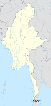
Kawthaung Airport
ကော့သောင် လေဆိပ် |
| IATA: KAW – ICAO: VYKT |
| Summary |
| Airport type |
Public |
| Serves |
Kawthaung |
| Location |
Kawthaung, Burma |
| Elevation AMSL |
55 m / 180 ft |
| Coordinates |
10°02′57.33″N 098°32′16.82″E / 10.0492583°N 98.5380056°E / 10.0492583; 98.5380056 |
| Runways |
| Direction |
Length |
Surface |
| m |
ft |
| 02/20 |
1,829 |
6,000 |
Asphalt |
Kawthaung Airport (Burmese: ကော့သောင် လေဆိပ်; (IATA: KAW, ICAO: VYKT)) is an airport in Kawthaung, Myanmar. The airport has a very small terminal with no gates. The airport has a 1800 x 50 meter runway.
Airlines and destinations
- Myanma Airways (Dawei, Myeik, Yangon)
- Air Bagan (Yangon)
The above content comes from Wikipedia and is published under free licenses – click here to read more.
| General Info
|
| Country |
Burma
|
| ICAO ID |
VYKT
|
| Time |
UTC+6:30
|
| Latitude |
10.049258
10° 02' 57.33" N
|
| Longitude |
98.538006
098° 32' 16.82" E
|
| Elevation |
180 feet
55 meters
|
| Magnetic Variation |
000° W (05/06)
|
| Operating Agency |
CIVIL GOVERNMENT, (LANDING FEES AND DIPLOMATIC CLEARANCE MAY BE REQUIRED)
|
| Runways
|
| ID |
Dimensions |
Surface |
PCN |
ILS
|
| 02/20 |
6000 x 150 feet
1829 x 46 meters |
ASPHALT |
- |
NO
|
| Navaids
|
| Type |
ID |
Name |
Channel |
Freq |
Distance From Field |
Bearing From Navaid
|
| NDB |
KT |
KAWTHOUNG |
- |
290 |
At Field |
-
|
| Remarks
|
| CSTMS/IMG |
Opr HO.
|
| LGT |
Thld lgt avbl.
|
| MISC |
Ldg fees.
|
| OPR HOURS |
Opr HO.
|
The content above was published at Airports-Worldwide.com in 2010.
We don't guarantee the information is fresh and accurate. The data may be wrong or outdated.
For more up-to-date information please refer to other sources.
|
|


