 |
|
Marechal Rondon International Airport
Aeroporto Internacional Marechal Rondon |
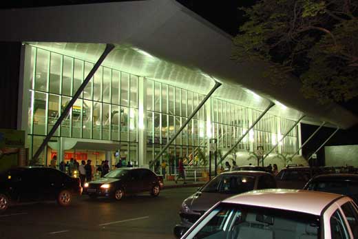 |
| External view of Marechal Rondon International Airport |
| IATA: CGB – ICAO: SBCY |
| Summary |
| Airport type |
Public |
| Operator |
Infraero |
| Serves |
Cuiabá |
| Location |
Várzea Grande, Brazil |
| Elevation AMSL |
617 ft / 188 m |
| Coordinates |
15°39′10″S 056°07′00″W / 15.65278°S 56.1166667°W / -15.65278; -56.1166667 |
| Website |
Infraero CGB |
| Runways |
| Direction |
Length |
Surface |
| m |
ft |
| 17/35 |
2,300 |
7,546 |
Asphalt |
| Statistics (2009) |
| Passengers |
1,671,704 |
| Aircraft Operations |
45,045 |
| Metric tonnes of cargo |
5,111 |
Statistics: Infraero
Sources: Airport Website |
Marechal Rondon International Airport (IATA: CGB, ICAO: SBCY) is an airport serving the Cuiabá-Várzea Grande conurbation in Mato Grosso, Brazil.It is named after the Marshall Cândido Mariano da Silva Rondon (1865-1958), a Brazilian explorer. It is located in the city of Várzea Grande, though most travel is actually destined for its larger neighbor Cuiabá. Hence, the airport is also called Cuiabá Airport. Airlines and destinations
| Airlines |
Destinations |
| Azul Brazilian Airlines |
Campinas-Viracopos |
| Avianca Brazil |
Brasília, Campo Grande, Curitiba-Afonso Pena |
| Gol Airlines |
Belo Horizonte-Confins, Brasília, Campo Grande, Curitiba-Afonso Pena, Goiânia, Manaus, Porto Velho, Presidente Prudente, Recife, Salvador da Bahia, São Paulo-Congonhas, São Paulo-Guarulhos |
| Passaredo Linhas Aéreas |
Franca, Goiânia, São Paulo-Congonhas, São Paulo-Guarulhos, Uberlândia |
| TAM Airlines |
Brasília, Campo Grande, Goiânia, Londrina, Ribeirão Preto, Rio de Janeiro-Santos Dumont, São José do Rio Preto, São Paulo-Congonhas, São Paulo-Guarulhos |
| TAM Airlines operated by Pantanal Linhas Aéreas |
São Paulo-Congonhas |
| TRIP Linhas Aéreas |
Alta Floresta, Campinas-Viracopos, Campo Grande, Cascavel, Curitiba-Afonso Pena, Goiânia, Dourados, Humaitá, Ji-Paraná, Lábrea, Londrina, Manaus, Maringá, Porto Velho, Ribeirão Preto, Rio Branco, Rio de Janeiro-Santos Dumont, Rondonópolis, Sinop, Vilhena |
Accidents and incidents
- 7 December 1960: Real, a Curtiss C-46A-60-CK Commando registration PP-AKF belonging to Transportes Aéreos Nacional, en route from Marechal Rondon International Airport to Manaus - Ponta Pelada crashed near Cachimbo, State of Pará. The engine no.2 failed during the flight. Altitude was lost, the pilot jettisoned some of the cargo but the aircraft continued to lose height. It crashed and caught fire. 15 passengers and crew died.
- 12 August 1965: Paraense, a Curtiss C-46A-50-CU Commando registration PP-BTH en route to Marechal Rondon International Airport caught fire and crashed on the location of Buracão, close do Barra do Bugre, in the State of Mato Grosso. All 13 passengers and crew died.
- 23 June 1985: TABA, a Embraer EMB 110 Bandeirante registration PT-GJN flying from Juara to Marechal Rondon International Airport, while on approach to land at Cuiabá, had technical problems on engine number 1. An emergency landing was attempted but the aircraft stalled and crashed 1 km short of the runway. All 17 occupants died.
Future developments
On 31 August 2009, Infraero unveiled a BRL30.9 million (USD16.3 million; EUR11.4 million) investiment plan to up-grade Marechal Rondon International Airport focusing on the preparations for the 2014 FIFA World Cup which will be held in Brazil, Cuiabá being one of the venue cities. The investiment will be distributed in the renovation of passenger the terminal, parking and access to the airport, with completion due in October 2012.
The above content comes from Wikipedia and is published under free licenses – click here to read more.
| General Info
|
| Country |
Brazil
|
| ICAO ID |
SBCY
|
| Time |
UTC-4(-3DT)
|
| Latitude |
-15.652931
15° 39' 10.55" S
|
| Longitude |
-56.116719
056° 07' 00.19" W
|
| Elevation |
617 feet
188 meters
|
| Type |
Civil
|
| Magnetic Variation |
015° W (01/06)
|
| Beacon |
Yes
|
| Operating Agency |
CIVIL GOVERNMENT, (LANDING FEES AND DIPLOMATIC CLEARANCE MAY BE REQUIRED)
|
| Near City |
Cuiaba
|
| Operating Hours |
24 HOUR OPERATIONS
|
| Communications
|
| CUIABA TWR |
118.1
|
| CUIABA APP |
119.4
120.35
|
| Runways
|
| ID |
Dimensions |
Surface |
PCN |
ILS
|
| 17/35 |
7546 x 148 feet
2300 x 45 meters |
ASPHALT |
038FBXT |
YES
|
| Navaids
|
| Type |
ID |
Name |
Channel |
Freq |
Distance From Field |
Bearing From Navaid
|
| VOR-DME |
CIA |
CUIABA |
084X |
113.7 |
At Field |
-
|
| NDB |
CIA |
CUIABA |
- |
380 |
At Field |
-
|
| Supplies/Equipment
|
| Fuel |
Jet A1, without icing nhibitor.
100/130 octane gasoline, leaded, MIL-L-5572F (GREEN)
|
| Remarks
|
| CAUTION |
Hi tension network 641' hi, 938' fr thld Rwy 17. Bird haz.
|
| FUEL |
(NC-100, A1)
|
| LGT |
PAPI Rwy 17 MEHT 71'. PAPI Rwy 35 MEHT 66'.
|
| MISC |
Flt pln acpt by phone.
|
| RSTD |
180 turns auth at thlds only. Acft prk on hardstand opposite TWR perform pushback before starting eng. Eng runups proh btn 0200-1000Z++.
|
The content above was published at Airports-Worldwide.com in 2010.
We don't guarantee the information is fresh and accurate. The data may be wrong or outdated.
For more up-to-date information please refer to other sources.
|
|


