|
|
Deputado Luis Eduardo Magalhaes Airport |
Salvador-Deputado Luís Eduardo Magalhães International Airport (2 de Julho)
Aeroporto Internacional de Salvador-Deputado Luís Eduardo Magalhães (2 de Julho) |
 |
| IATA: SSA – ICAO: SBSV |
| Summary |
| Airport type |
Public/Military |
| Operator |
Infraero |
| Serves |
Salvador da Bahia |
| Elevation AMSL |
20 m / 64 ft |
| Coordinates |
12°54′39″S 38°19′51″W / 12.91083°S 38.33083°W / -12.91083; -38.33083 |
| Website |
Infraero SSA |
| Runways |
| Direction |
Length |
Surface |
| m |
ft |
| 10/28 |
3,005 |
9,859 |
Asphalt |
| 17/35 |
1,519 |
4,985 |
Asphalt |
| Statistics (2009) |
| Passengers |
7,052,720 |
| Aircraft Operations |
102,211 |
| Metric tonnes of cargo |
36,981 |
Statistics: Infraero
Sources: Airport Website |
Salvador-Deputado Luís Eduardo Magalhães International Airport (IATA: SSA, ICAO: SBSV), more commonly known as it was formerly named: Dois de Julho International Airport. It is located in Salvador, Bahia, Brazil. It is administered by Infraero, and lies 20 km (12 mi) north of downtown Salvador. The airport is located in an area of more than 6 million square meters between sand dunes and native vegetation. The road route to the airport has already become one of the city's main scenic attractions. In 2008, the airport handled 6,042,307 passengers and 95,804 aircraft movements, placing it 5th busiest airport in Brazil in terms of passengers.
The airport's use has been growing at an average of 14% a year and now is responsible for more than 30% of passenger movement in Brazil's Northeast. Nearly 35 thousand people circulate daily through the passenger terminal. The airport generates more than 16 thousand direct and indirect jobs, to serve a daily average of over 10 thousand passengers, 250 takeoffs and landings of 100 domestic and 16 international flights.
Many of these flights are domestic flights from within Brazil where Salvador serves as a major transfer point for flights to and from smaller cities throughout the Northeastern Brazil. Salvador International Airport has international service to North America, South America, Europe, and Africa. History
The airport was founded in 1925, and was completely rebuilt in 1941 by Panair do Brasil ("necessities of war", declared the American and the Brazilian governments). Its old name was Santo Amaro do Ipitanga. In 1955, the airport changed its name to Dois de Julho, and, in 1998, to the present name, although Salvador's inhabitants mostly continue to refer to the airport by the older name Dois de Julho, which commemorates Bahia Independence Day.
On 31 August 2009 Infraero unveiled an ambitious BRL5.3 billion (USD2.8 billion; EUR2.0 billion) investment plan to renovate and upgrade airports of ten cities focusing on the preparations for the 2014 FIFA World Cup which will be held in Brazil. At the occasion it was announced that even though they are venue cities, the plan excluded Salvador and Natal airports because renovations had been recently completed and Infraero considered the airports fit to handle the forthcoming increases in traffic.
General information
- Main terminal: 69,400 m²
- Number of jetways: 11
- Capacity: 6,000,000 passengers
- Direct jobs: 4,000
Airlines and destinations
 | |
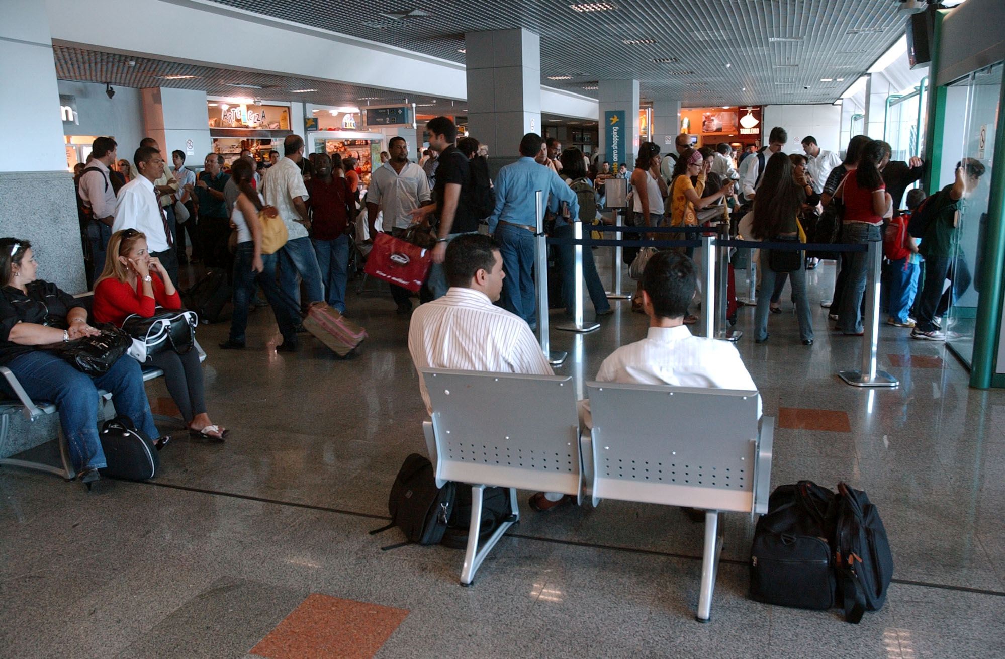
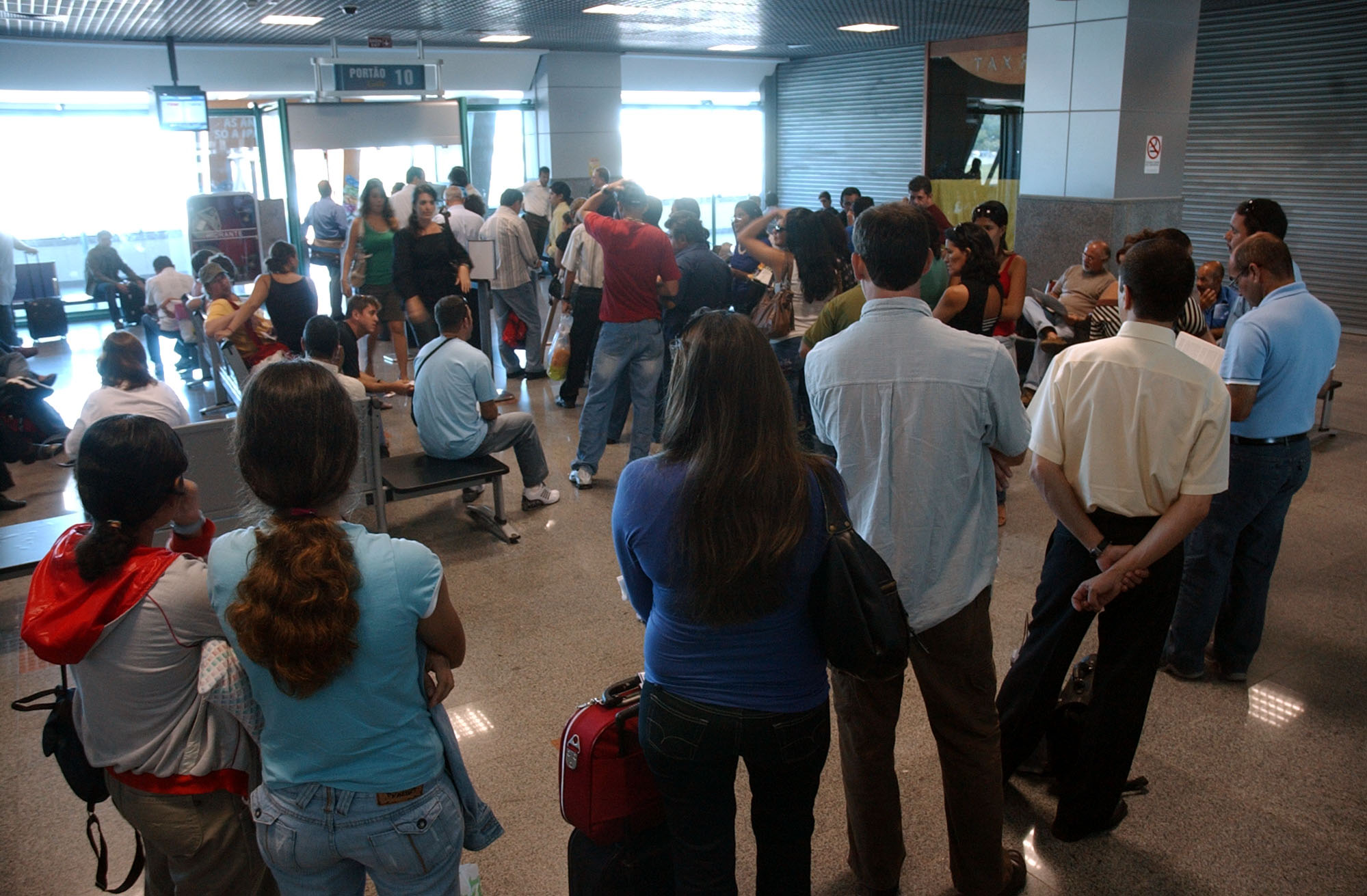
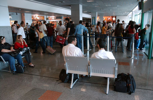
Inside the airport. |
 | |
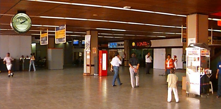
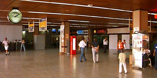
Salvador's airport. |
 | |
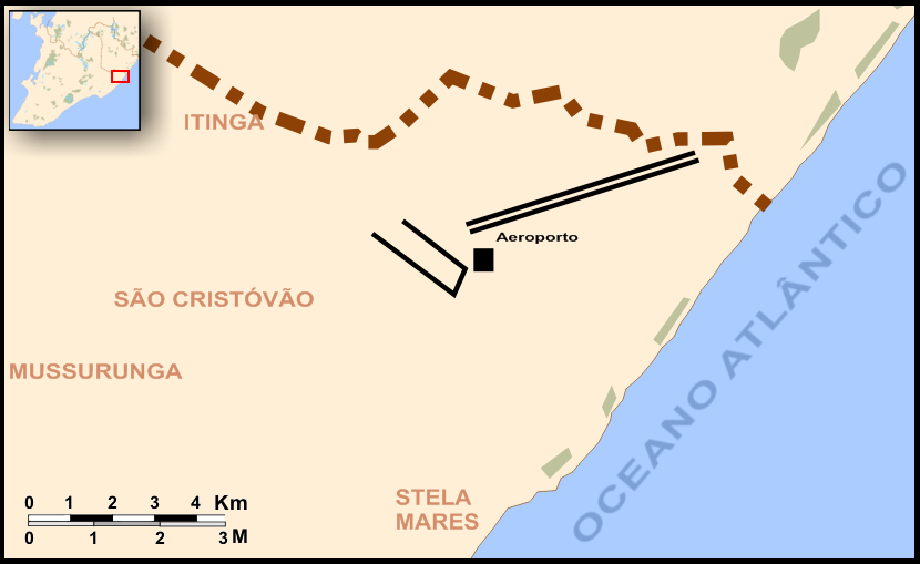
Map view. |
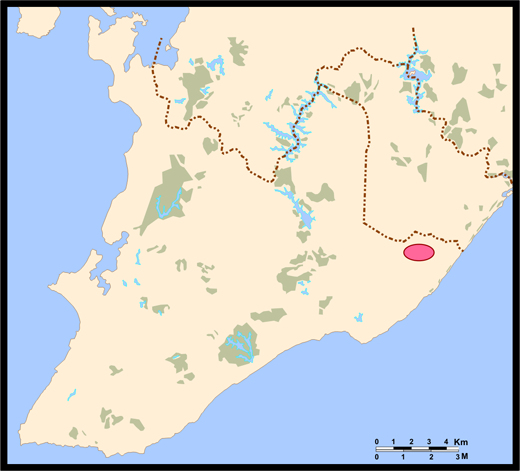 | |
Location of airport in Salvador. |
| Airlines |
Destinations |
| Abaeté Linhas Aéreas |
Bom Jesus da Lapa, Guanambi |
| Aerolíneas Argentinas |
Buenos Aires-Aeroparque [ends 19 October; resumes 6 December], Buenos Aires-Ezeiza [begins 20 October; ends 5 December] |
| Air Europa |
Madrid [resumes 2 November] |
| Air Italy |
Milan-Malpensa |
| American Airlines |
Miami |
| Avianca Brazil |
Brasília, Petrolina, Recife, São Paulo-Guarulhos |
| Azul Brazilian Airlines |
Campinas-Viracopos, Rio de Janeiro-Santos Dumont, Vitória |
| Condor |
Frankfurt |
| Iberworld |
Madrid |
| Gol Airlines |
Aracaju, Belém-Val de Cães, Belo Horizonte-Confins, Brasília, Campinas-Viracopos, Cuiabá, Fortaleza, Ilhéus, João Pessoa, Maceió, Manaus, Natal, Porto Alegre, Porto Seguro, Recife, Rio de Janeiro-Galeão, Rio de Janeiro-Santos Dumont, São Luís, São Paulo-Congonhas, São Paulo-Guarulhos |
| Livingston Energy Flight |
Milan-Malpensa [seasonal] |
| Passaredo |
Brasília, Barreiras, Ribeirão Preto, São Paulo-Guarulhos, Vitória da Conquista |
| TAM Airlines |
Belém-Val de Cães, Belo Horizonte-Confins, Brasília, Buenos Aires-Ezeiza, Campinas-Viracopos, Curitiba-Afonso Pena, Fortaleza, Foz do Iguaçu, Ilhéus, João Pessoa, Manaus, Natal, Porto Alegre, Porto Seguro, Recife, Rio de Janeiro-Galeão, Rio de Janeiro-Santos Dumont, Santarém, São Luís, São Paulo-Congonhas, São Paulo-Guarulhos |
| TAM Airlines operated by Pantanal Linhas Aéreas |
Rio de Janeiro-Galeão, São Paulo-Congonhas |
| TAP Portugal |
Lisbon |
| TRIP |
Aracaju, Fernando de Noronha, Ilhéus, Lençóis, Natal, Petrolina, Recife, Vitória, Vitória da Conquista |
| Webjet |
Belo Horizonte-Confins, Brasília, Curitiba-Afonso Pena, Fortaleza, Porto Alegre, Recife, Rio de Janeiro-Galeão |
a.^ Airline operating regular charter flights.
Accidents and incidents
Accidents with fatalities
- 21 September 1944: Panair do Brasil, a Lockheed Model 18 Lodestar registration PP-PBH crashed shortly after take-off from Salvador. All 17 occupants died.
- 30 May 1950: Aerovias Brasil, a Douglas C-47-DL registration PP-AVZ, en route from Vitória da Conquista to Salvador disintegrated on air, while flying over Itacaré, near Ilhéus. It was flying under extremely bad conditions and entered a cumulus nimbus. Passengers and cargo were moved aboard and as a consequence control was lost. Both wings separated from the aircraft as it descended at great speed. Of the 15 passengers and crew aboard, 2 survived.
Incidents
- 15 May 1973: VASP, a Vickers Viscount registration PP-SRD was damaged beyond economic repair when it departed the runway on landing and the undercarriage collapsed.
The above content comes from Wikipedia and is published under free licenses – click here to read more.
| General Info
|
| Country |
Brazil
|
| ICAO ID |
SBSV
|
| Time |
UTC-3(-2DT)
|
| Latitude |
-12.910994
12° 54' 39.58" S
|
| Longitude |
-38.331044
038° 19' 51.76" W
|
| Elevation |
64 feet
20 meters
|
| Type |
Joint (Civil and Military)
|
| Magnetic Variation |
023° W (01/06)
|
| Beacon |
Yes
|
| Operating Agency |
MILITARY - CIVIL JOINT USE AIRPORT
|
| Alternate Name |
SALVADOR
|
| Near City |
Salvador
|
| Operating Hours |
24 HOUR OPERATIONS
|
| International Clearance Status |
Airport of Entry
|
| Communications
|
| SALVADOR TWR |
118.3
|
SALVADOR OPS
Military aircraft only.
|
122.5
|
| GND |
121.9
|
| SALVADOR TRAFFIC |
121.1
|
| SALVADOR ATIS |
127.75
|
| SALVADOR CON |
120.8
119.8
119.35
|
| Runways
|
| ID |
Dimensions |
Surface |
PCN |
ILS
|
| 10/28 |
9859 x 148 feet
3005 x 45 meters |
ASPHALT |
074FBXT |
YES
|
| 17/35 |
4985 x 148 feet
1519 x 45 meters |
ASPHALT |
027FCYT |
NO
|
| Navaids
|
| Type |
ID |
Name |
Channel |
Freq |
Distance From Field |
Bearing From Navaid
|
| VOR-DME |
SVD |
SALVADOR |
112X |
116.5 |
At Field |
-
|
| NDB |
SVD |
SALVADOR |
- |
275 |
At Field |
-
|
| Supplies/Equipment
|
| Fuel |
Jet A1, without icing nhibitor.
100/130 octane gasoline, leaded, MIL-L-5572F (GREEN)
|
| Remarks
|
| CAUTION |
Bird haz. Poles btn 883' and 1844' fr thld Rwy 17, btn 005 and 006 , elev btn 59' and 121'. Hi tension line 11,263' fr thld Rwy 17, 344 , elev 275'. Poles btn 4754' and 4875' fr thld Rwy 10, btn 275 and 278 , elev 126'. Antenna 1312' frthld Rwy 10, 394' left, elev 39'.
|
| FUEL |
(NC-100, A1)
|
| LGT |
PAPI Rwy 10 GS 2.9 , MEHT 70'.
|
| MISC |
Flt pln acpt by phone.
|
| RSTD |
AMC chan msn will nml prk on civ ramp, while special msn will nml prk on mil ramp.
|
The content above was published at Airports-Worldwide.com in 2010.
We don't guarantee the information is fresh and accurate. The data may be wrong or outdated.
For more up-to-date information please refer to other sources.
|
|