|
|
Sua Pan Airport or Sowa Airport (IATA: SXN, ICAO: FBSN) is an airport 11 kilometres (6.8 mi) west of Sowa, a town in the Central District of Botswana.
The runway is between the north and south basins of the Sua Pan (also known as Sowa Pan), a salt pan where sodium carbonate (soda ash) is mined. Sowa means salt in the language of the San.
|
Sua Pan Airport
Sowa Airport
|
|
|
| Summary |
| Airport type |
Private |
| Serves |
Sowa, Botswana |
| Location |
Sua Pan |
| Elevation AMSL |
2,985 ft / 910 m |
| Coordinates |
20°33′12″S
26°06′55″E |
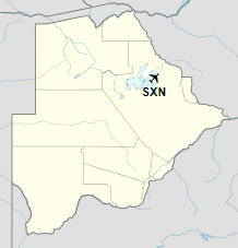
| Map |
Location of airport in Botswana
|
| Runways |
| Direction |
Length |
Surface |
| m |
ft |
| 11/29 |
1,675 |
5,495 |
Asphalt |
|
The above content comes from Wikipedia and is published under free licenses – click here to read more.
| General Info
|
| Country |
Botswana
|
| ICAO ID |
FBSN
|
| Time |
UTC+2
|
| Latitude |
-20.553361
20° 33' 12.10" S
|
| Longitude |
26.115778
026° 06' 56.80" E
|
| Elevation |
2985 feet
910 meters
|
| Magnetic Variation |
010° W (05/06)
|
| Operating Agency |
PRIVATE
|
| Runways
|
| ID |
Dimensions |
Surface |
PCN |
ILS
|
| 11/29 |
5381 x 66 feet
1640 x 20 meters |
ASPHALT |
050FAXT |
NO
|
| Remarks
|
| OPR HOURS |
Opr HO.
|
| RSTD |
PPR.
|
The content above was published at Airports-Worldwide.com in 2019.
We don't guarantee the information is fresh and accurate. The data may be wrong or outdated.
For more up-to-date information please refer to other sources.
|
|