|
|
Francistown International Airport |
Phillip Gaonwe Matante International Airport (IATA: FRW, ICAO: FBFT) is an airport serving Francistown, Botswana. The airport is on the western edge of the city.
The Francistown VOR-DME (Ident: FTV) is located on the field.
The new terminal building opened in 2011 and the old terminal at the eastern end of the airport was transferred to the Botswana Defence Force.
|
Phillip Gaonwe Matante International Airport
Francistown Air Base
|
|
|
| Summary |
| Airport type |
Public/Military |
| Operator |
Civil Government, Botswana Defence Force |
| Serves |
Francistown |
| Elevation AMSL |
3,312 ft / 1,009 m |
| Coordinates |
21°09′35″S
27°28′30″E |
| Website |
caab.co.bw |
| Map |
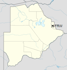
Location of the airport in Botswana
|
| Runways |
| Direction |
Length |
Surface |
| m |
ft |
| 11/29 |
2,230 |
7,316 |
Asphalt |
| 13/31 |
3,000 |
9,843 |
Asphalt |
|
Airline and destinations
| Destinations |
| Air Botswana |
Gaborone, Johannesburg–OR Tambo |
Botswana Defence Force Air Wing
Francistown is home to Botswana Defence Force Air Wing’s Z3 Transport(Liaison) Squadron and Z12 Transport Squadron. It is located in the old terminal building at the east end of the airport.
The above content comes from Wikipedia and is published under free licenses – click here to read more.
| General Info
|
| Country |
Botswana
|
| ICAO ID |
FBFT
|
| Time |
UTC+2
|
| Latitude |
-21.159597
21° 09' 34.55" S
|
| Longitude |
27.474525
027° 28' 28.29" E
|
| Elevation |
3283 feet
1001 meters
|
| Type |
Civil
|
| Magnetic Variation |
011° W (05/06)
|
| Operating Agency |
CIVIL GOVERNMENT, (LANDING FEES AND DIPLOMATIC CLEARANCE MAY BE REQUIRED)
|
| International Clearance Status |
Airport of Entry
|
| Communications
|
TWR
Opr 0500-1700Z.
|
118.1
|
APP
Opr 0500-1700Z.
|
125.7
|
| Runways
|
| ID |
Dimensions |
Surface |
PCN |
ILS
|
| 11/29 |
7218 x 98 feet
2200 x 30 meters |
ASPHALT |
025FBYU |
NO
|
| 16/34 |
4147 x 72 feet
1264 x 22 meters |
GRAVEL. |
- |
NO
|
| Navaids
|
| Type |
ID |
Name |
Channel |
Freq |
Distance From Field |
Bearing From Navaid
|
| VOR-DME |
FTV |
FRANCISTOWN |
071X |
112.4 |
At Field |
-
|
| Supplies/Equipment
|
| Fuel |
Jet A1, without icing nhibitor.
100/130 MIL Spec, low lead, aviation gasoline (BLUE)
|
| Remarks
|
| CAUTION |
Unctl game act vcnty afld.
|
| FUEL |
Avbl 0600-1100Z, 1200-1500Z Mon-Fri; 1000-1100Z Sat; OT PN rqr. (NC-100LL, A1)
|
| OPR HOURS |
Opr HO.
|
The content above was published at Airports-Worldwide.com in 2019.
We don't guarantee the information is fresh and accurate. The data may be wrong or outdated.
For more up-to-date information please refer to other sources.
|
|