|
|
Yacuiba Airport (Spanish: Aeropuerto Yacuiba, (IATA: BYC, ICAO: SLYA)) is an airport 4 kilometres (2.5 mi) north of Yacuiba, a city in the Tarija Department of Bolivia.
The runway is in a north-south aligned valley, with rising terrain to the east, and the Cordillera Central mountains 2.5 kilometres (1.6 mi) to the west.
The Yacuiba non-directional beacon (Ident: YAC) is located on the field.
|
Yacuiba Airport
|
|
|
| Summary |
| Airport type |
Public |
| Serves |
Yacuíba |
| Elevation AMSL |
2,116 ft / 645 m |
| Coordinates |
21°57′40″S
63°39′07″W |
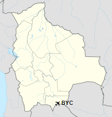
| Map |
Location of airport in Bolivia
|
| Runways |
| Direction |
Length |
Surface |
| m |
ft |
| 02/20 |
2,100 |
6,890 |
Asphalt |
|
Airlines and destinations
| Destinations |
| Amaszonas |
Santa Cruz de la Sierra, Tarija |
| Boliviana de Aviación |
Tarija |
The above content comes from Wikipedia and is published under free licenses – click here to read more.
| General Info
|
| Country |
Bolivia
|
| ICAO ID |
SLYA
|
| Time |
UTC-4
|
| Latitude |
-21.960925
21° 57' 39.33" S
|
| Longitude |
-63.651669
063° 39' 06.01" W
|
| Elevation |
2116 feet
645 meters
|
| Magnetic Variation |
008° W (05/06)
|
| Operating Agency |
CIVIL GOVERNMENT, (LANDING FEES AND DIPLOMATIC CLEARANCE MAY BE REQUIRED)
|
| Operating Hours |
SUNRISE TO SUNSET (SR-SS)
|
| Communications
|
TWR
1000Z-2300Z
|
118.3
|
RDO
1000Z-2300Z
|
6622
|
| Runways
|
| ID |
Dimensions |
Surface |
PCN |
ILS
|
| 02/20 |
6890 x 118 feet
2100 x 36 meters |
ASPHALT |
048FCXT |
NO
|
| Navaids
|
| Type |
ID |
Name |
Channel |
Freq |
Distance From Field |
Bearing From Navaid
|
| NDB |
YAC |
YACUIBA |
- |
385 |
At Field |
-
|
| Supplies/Equipment
|
| Fuel |
Jet A1, without icing nhibitor.
|
| Remarks
|
| FUEL |
Avbl SR-SS. (NC-A1, 100LL)
|
| OPR HOURS |
Opr SR-SS
|
The content above was published at Airports-Worldwide.com in 2019.
We don't guarantee the information is fresh and accurate. The data may be wrong or outdated.
For more up-to-date information please refer to other sources.
|
|