|
|
Capitan Nicolas Rojas Airport |
Capitán Nicolas Rojas Airport (Spanish: Aeropuerto Capitán Nicolas Rojas) (IATA: POI, ICAO: SLPO) is an extremely high elevation airport serving the city of Potosí, the capital of the Potosí Department in Bolivia.
The runway is in a shallow valley 4 kilometres (2.5 mi) northeast of the city, with mountainous terrain in a quadrants.
The Potosi VOR-DME (Ident: PTS) is located 1.4 nautical miles (2.6 km) off the approach threshold of Runway 24. The Potosi non-directional beacon (Ident: POI) is located on the field.
|
Capitán Nicolas Rojas Airport
Aeropuerto Capitán Nicolas Rojas
|
|
|
| Summary |
| Airport type |
Public |
| Operator |
Government |
| Serves |
Potosí, Bolivia |
| Elevation AMSL |
12,913 ft / 3,936 m |
| Coordinates |
19°32′35″S
065°43′25″W |
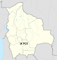
| Map |
Location of the airport in Bolivia
|
| Runways |
| Direction |
Length |
Surface |
| m |
ft |
| 06/24 |
2,833 |
9,295 |
Asphalt |
|
Airlines and destinations
| Destinations |
| Boliviana de Aviación |
Cochabamba, La Paz, Santa Cruz |
The above content comes from Wikipedia and is published under free licenses – click here to read more.
| General Info
|
| Country |
Bolivia
|
| ICAO ID |
SLPO
|
| Time |
UTC-4
|
| Latitude |
-19.543069
19° 32' 35.05" S
|
| Longitude |
-65.723706
065° 43' 25.34" W
|
| Elevation |
12913 feet
3936 meters
|
| Magnetic Variation |
007° W (05/06)
|
| Operating Agency |
CIVIL GOVERNMENT, (LANDING FEES AND DIPLOMATIC CLEARANCE MAY BE REQUIRED)
|
| Near City |
Potosi
|
| Communications
|
| POTOSI TWR |
118.3
|
| POTOSI RDO |
6622
|
| Runways
|
| ID |
Dimensions |
Surface |
PCN |
ILS
|
| 06/24 |
9295 x 98 feet
2833 x 30 meters |
ASPHALT |
034FBXT |
NO
|
| Navaids
|
| Type |
ID |
Name |
Channel |
Freq |
Distance From Field |
Bearing From Navaid
|
| NDB |
POI |
POTOSI |
- |
400 |
At Field |
-
|
| Supplies/Equipment
|
| Fuel |
Jet A1, without icing nhibitor.
|
| Remarks
|
| CAUTION |
Significant wind shear on apch and dep.
|
| OPR HOURS |
Opr 1030-1500Z, 1800-2100Z Mon-Fri; 1130-1700Z Sat; Sun O/R.
|
| RSTD |
VFR only
|
The content above was published at Airports-Worldwide.com in 2019.
We don't guarantee the information is fresh and accurate. The data may be wrong or outdated.
For more up-to-date information please refer to other sources.
|
|