|
|
Saint-Hubert Air Base (Base aérienne de Saint-Hubert) (ICAO: EBSU) is a military airport located northeast of Saint-Hubert, a municipality in the province of Luxembourg in Wallonia (southern Belgium).
The base is southeast of the Saint-Hubert Airport (Aérodrome de Saint-Hubert) (ICAO: EBSH), which is located at 50°02′09″N 005°24′15″E.
|
Saint-Hubert Air Base
Base aérienne de Saint-Hubert
|
|
|
| Summary |
| Airport type |
Military |
| Location |
Saint-Hubert, Wallonia, Belgium |
| Elevation AMSL |
1,930 ft / 588 m |
| Coordinates |
50°02′03″N
005°26′24″E |
| Map |
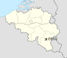
Location of Saint-Hubert Air Base
|
| Runways |
| Direction |
Length |
Surface |
| m |
ft |
| 07/25 |
2,600 |
8,530 |
Concrete/Asphalt |
|
The above content comes from Wikipedia and is published under free licenses – click here to read more.
| General Info
|
| Country |
Belgium
|
| ICAO ID |
EBSU
|
| Time |
UTC+1(+2DT)
|
| Latitude |
50.035833
50° 02' 09.00" N
|
| Longitude |
5.404167
005° 24' 15.00" E
|
| Elevation |
1930 feet
588 meters
|
| Magnetic Variation |
000° W (05/06)
|
| Operating Agency |
MILITARY
|
| Operating Hours |
UNKNOWN
|
| Daylight Saving Time |
Last Sunday in March to last Sunday in October
|
| Runways
|
| ID |
Dimensions |
Surface |
PCN |
ILS
|
| 07/25 |
8528 x 147 feet
2599 x 45 meters |
CONCRETE. |
- |
NO
|
| Supplies/Equipment
|
| Fuel |
Jet fuel avaiable but type is unknown.
|
The content above was published at Airports-Worldwide.com in 2019.
We don't guarantee the information is fresh and accurate. The data may be wrong or outdated.
For more up-to-date information please refer to other sources.
|
|