 |
|
| Shah Amanat International Airport |
 |
| IATA: CGP – ICAO: VGEG |
| Summary |
| Airport type |
Military/Public |
| Operator |
Civil Aviation Authority of Bangladesh |
| Location |
Chittagong |
| Elevation AMSL |
12 ft / 4 m |
| Coordinates |
22°14′59″N 91°48′48″E / 22.24972°N 91.81333°E / 22.24972; 91.81333Coordinates: 22°14′59″N 91°48′48″E / 22.24972°N 91.81333°E / 22.24972; 91.81333 |
| Runways |
| Direction |
Length |
Surface |
| ft |
m |
| 05/23 |
9,646 |
2,940 |
Concrete/Asphalt |
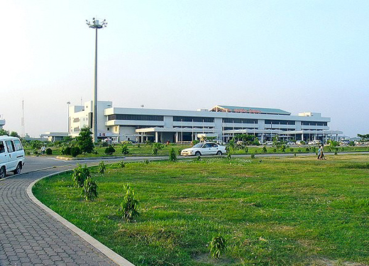
Shah Amanat International Airport (IATA: CGP, ICAO: VGEG), named after an Islamic saint, serves Bangladesh's south-eastern port city of Chittagong. It was formerly known as MA Hannan International Airport but was renamed on 2 April 2005 by the Government of Bangladesh. The move was controversial since the previous name honored a member of the Awami League who were the opposition party at the time.
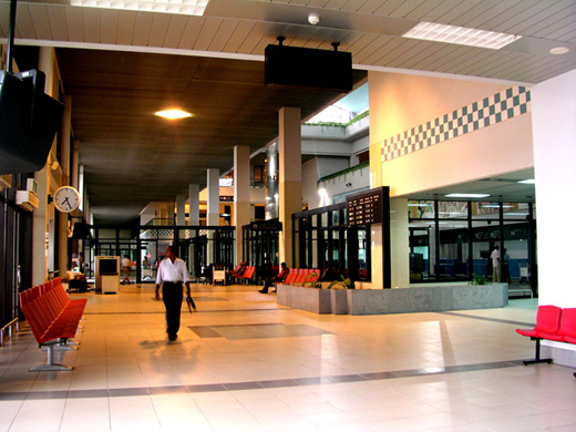 | |
Inside the terminal |
Airlines and destinations
| Airlines |
Destinations |
| Air Arabia |
Sharjah |
| Biman Bangladesh Airlines |
Abu Dhabi, Cox's Bazar, Dhaka, Dubai, Jeddah,Muscat, Riyadh,Dammam,Doha |
| Bahrain Air |
Bahrain |
| GMG Airlines |
Bangkok, Dhaka |
| Kuwait Airways |
Kuwait |
| Oman Air |
Muscat |
| United Airways |
Dhaka, Kolkata, Sylhet |
World War II
Known as Chittagong Airfield during World War II, the airport was used as a combat airfield, as well as a supply point and photographic reconnaissance base by the United States Army Air Force Tenth Air Force during the Burma Campaign 1944-1945.
Known American units assigned to Chittagong were:
- 80th Fighter Group, flew P-38 Lightning fighters over Burma between March 1944 and February 1945.
- 8th Reconnaissance Group, between October and December 1944 (various detachments)
- 4th Combat Cargo Group, flew C-46 Commando transports between January and June 1945.
From the airport, the 4th CCG C-46's flew supplies and ammunition which were air-dropped to the advancing Allied forces on the ground. At the end of June, control of the airport was returned to local authorities.
The above content comes from Wikipedia and is published under free licenses – click here to read more.
| General Info
|
| Country |
Bangladesh
|
| ICAO ID |
VGEG
|
| Time |
UTC+6
|
| Latitude |
22.249611
22° 14' 58.60" N
|
| Longitude |
91.813286
091° 48' 47.83" E
|
| Elevation |
12 feet
4 meters
|
| Type |
Joint (Civil and Military)
|
| Magnetic Variation |
000° W (05/06)
|
| Beacon |
Yes
|
| Operating Agency |
MILITARY - CIVIL JOINT USE AIRPORT
|
| Alternate Name |
M A HANNAN INTL
|
| Near City |
Chittagong
|
| International Clearance Status |
Airport of Entry
|
| Communications
|
| CHITTAGONG TWR |
118.7
|
| CHITTAGONG GND |
121.8
|
| ATIS |
127.6
|
| Runways
|
| ID |
Dimensions |
Surface |
PCN |
ILS
|
| 05/23 |
9646 x 150 feet
2940 x 46 meters |
PART CONCRETE, PART ASPHALT, OR PART BITUMEN-BOUND MACADAM. |
066FCXT |
YES
|
| Navaids
|
| Type |
ID |
Name |
Channel |
Freq |
Distance From Field |
Bearing From Navaid
|
| VOR-DME |
CTG |
CHITTAGONG |
081X |
113.4 |
At Field |
-
|
| NDB |
EG |
CHITTAGONG |
- |
287 |
At Field |
-
|
| Supplies/Equipment
|
| Fuel |
Jet A1, without icing nhibitor.
100/130 MIL Spec, low lead, aviation gasoline (BLUE)
|
| Remarks
|
| CAUTION |
Acft ldg Rwy 23 if past turnoff taxi back rqr on rwy.
|
| CSTMS/AG/IMG |
Avbl.
|
| FUEL |
Avbl 0000-1600Z. (NC-100LL, A1)
|
| OPR HOURS |
Opr HO.
|
The content above was published at Airports-Worldwide.com in 2010.
We don't guarantee the information is fresh and accurate. The data may be wrong or outdated.
For more up-to-date information please refer to other sources.
|
|


