|
|
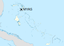
Sandy Point Airport (ICAO: MYAS) is an airstrip serving Sandy Point on Abaco Island in The Bahamas.
|
Sandy Point Airport
|
|
|
| Summary |
| Airport type |
Public |
| Serves |
Sandy Point, Abaco Island, Bahamas |
| Elevation AMSL |
8 ft / 2 m |
| Coordinates |
26°00′17″N
077°23′44″W |
| Map |
|
|
| Runways |
| Direction |
Length |
Surface |
| m |
ft |
| 10/28 |
1,372 |
4,501 |
Asphalt |
|
Facilities
The airport resides at an elevation of 8 ft (2.4 m) above mean sea level. It has one runway designated 10/28 with an asphalt surface measuring 1,372 m × 30 m (4,501 ft × 98 ft).
The above content comes from Wikipedia and is published under free licenses – click here to read more.
| General Info
|
| Country |
Bahamas, The
|
| ICAO ID |
MYAS
|
| Time |
UTC-5 (-4DT)
|
| Latitude |
26.004639
26° 00' 16.70" N
|
| Longitude |
-77.395483
077° 23' 43.74" W
|
| Elevation |
8 feet
2 meters
|
| Magnetic Variation |
007° W (05/06)
|
| Operating Agency |
CIVIL GOVERNMENT, (LANDING FEES AND DIPLOMATIC CLEARANCE MAY BE REQUIRED)
|
| Island Group |
Abaco I
|
| Operating Hours |
SUNRISE TO SUNSET (SR-SS)
|
| International Clearance Status |
Airport of Entry
|
| Runways
|
| ID |
Dimensions |
Surface |
PCN |
ILS
|
| 10/28 |
4500 x 100 feet
1372 x 30 meters |
ASPHALT |
- |
NO
|
| Remarks
|
| OPR HOURS |
Opr SR-SS.
|
The content above was published at Airports-Worldwide.com in 2020.
We don't guarantee the information is fresh and accurate. The data may be wrong or outdated.
For more up-to-date information please refer to other sources.
|
|