|
|
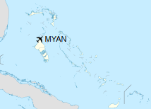
San Andros Airport (IATA: SAQ, ICAO: MYAN) is an airport near Nicholls Town on Andros Island in The Bahamas.
|
San Andros Airport
|
|
|
| Summary |
| Airport type |
Public |
| Serves |
Nicholls Town, Andros Island, Bahamas |
| Hub for |
Passenger
|
| Elevation AMSL |
5 ft / 2 m |
| Coordinates |
25°03′14″N
078°02′56″W |
| Map |
|
|
| Runways |
| Direction |
Length |
Surface |
| m |
ft |
| 12/30 |
1,524 |
5,000 |
Bitumen |
|
Facilities
The airport resides at an elevation of 5 ft (1.5 m) above mean sea level. It has one runway designated 12/30 with a bitumen surface measuring 1,524 m × 23 m (5,000 ft × 75 ft).
The airport has services from Westernair, Bahamasair, Lynx (from Fort Lauderdale) and other small twin engine charter planes that run between the islands.
Since November 2006, the airport has Av Gas and Jet A available from Westernair. The newly built Western Executive Jet Center has big screen TV, executive style bathrooms, conference rooms, pilot lounges, passenger area, delicatessen, and a VIP lounge. They also have a maintenance hangar for their aircraft and executive planes and a terminal for domestic flights.
Airlines and destinations
Scheduled passenger service from this airport is provided by the following airlines:
| Destinations |
| AirExpress |
Nassau |
| Western Air |
Nassau |
The above content comes from Wikipedia and is published under free licenses – click here to read more.
| General Info
|
| Country |
Bahamas, The
|
| ICAO ID |
MYAN
|
| Time |
UTC-5 (-4DT)
|
| Latitude |
25.053814
25° 03' 13.73" N
|
| Longitude |
-78.048997
078° 02' 56.39" W
|
| Elevation |
5 feet
2 meters
|
| Magnetic Variation |
006° W (05/06)
|
| Operating Agency |
CIVIL GOVERNMENT, (LANDING FEES AND DIPLOMATIC CLEARANCE MAY BE REQUIRED)
|
| Island Group |
Andros I
|
| Operating Hours |
SUNRISE TO SUNSET (SR-SS)
|
| International Clearance Status |
Airport of Entry
|
| Daylight Saving Time |
Second Sunday in March at 0200 to first Sunday in November at 0200 local time (Exception Arizona and that portion of Indiana in the Eastern Time Zone)
|
| Communications
|
| UNICOM |
122.8
|
| Runways
|
| ID |
Dimensions |
Surface |
PCN |
ILS
|
| 12/30 |
5000 x 75 feet
1524 x 23 meters |
BITUMINOUS, TAR OR ASPHALT MIXED IN PLACE, OILED. |
- |
NO
|
| Remarks
|
| OPR HOURS |
Opr SR-SS.
|
The content above was published at Airports-Worldwide.com in 2020.
We don't guarantee the information is fresh and accurate. The data may be wrong or outdated.
For more up-to-date information please refer to other sources.
|
|