|
|
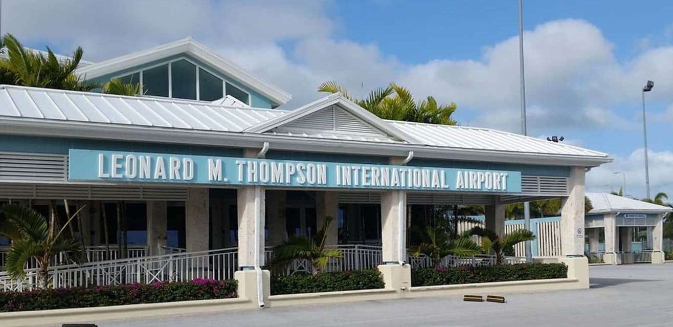
Leonard M. Thompson International Airport |
Leonard M. Thompson International Airport, formerly known as The Marsh Harbour International Airport (IATA: MHH, ICAO: MYAM), is an airport serving Marsh Harbour, a town in the Abaco Islands, The Bahamas. Leonard M. Thompson International Airport is the second busiest airport in the Bahamas and the second largest international gateway into the country only after Lynden Pindling International Airport in Nassau.
Marsh Harbour is a major tourist attraction. The airport offers scheduled passenger flights to Nassau and several destinations in Florida as well as regional jet flights nonstop to Charlotte and Miami in the U.S. In 2007 a new runway was built to allow larger, regional jets to operate from Marsh Harbour. A new airport terminal was opened on 27 May 2014.
|
Leonard M. Thompson International Airport
|
|
|
|
| Summary |
| Airport type |
Public |
| Owner |
Bahamas Government |
| Operator |
Department of Civil Aviation |
| Serves |
Marsh Harbour, Abaco Islands, Bahamas |
| Location |
Marsh Harbour,Abaco |
| Elevation AMSL |
6 ft / 2 m |
| Coordinates |
26°30′41″N
077°05′01″W |
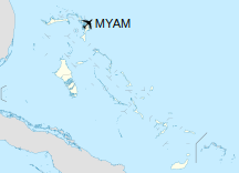
| Map |
|
|
| Runways |
| Direction |
Length |
Surface |
| m |
ft |
| 09/27 |
1,859.3 |
6,100 |
Asphalt |
|
Facilities
The airport has an elevation of 6 ft (1.8 m) above mean sea level. It has one runway, designated 09/27, that has an asphalt surface measuring 1,859.3 m × 30 m (6,100 ft × 98 ft). In 2006 the old runway was converted into a taxiway after 6,100 ft (1,859 m) runway has opened. The new Leonard M. Thompson International Airport terminal opened on 27 May 2014 after three years of construction.
The new terminal incorporates architectural elements that reflect culture of The Bahamas. The new 51,000-square-foot terminal has 22 counter positions, a new luggage scanning system, pilot briefing room, two restaurants, one lounge, shops, and a public parking area.
Marsh Harbour International Airport was renamed the Leonard M. Thompson International Airport on May 25, 2016. Thompson was a son of Hope Town and a prominent aviator who was a bomber pilot for the Royal Canadian Air Force (RCAF) during World War II.
Airlines and destinations
Passenger
| Destinations |
| American Eagle |
Charlotte, Miami |
| Bahamasair |
Nassau, West Palm Beach |
| Flamingo Air |
Freeport |
| Silver Airways |
Fort Lauderdale
Seasonal: Orlando, Tampa, West Palm Beach |
| SkyBahamas |
Fort Lauderdale, Nassau |
| Tropic Ocean Airways |
Fort Lauderdale |
| WesternAir |
Freeport, Nassau |
Cargo
| Destinations |
| IBC Airways |
Miami |
Accidents and incidents
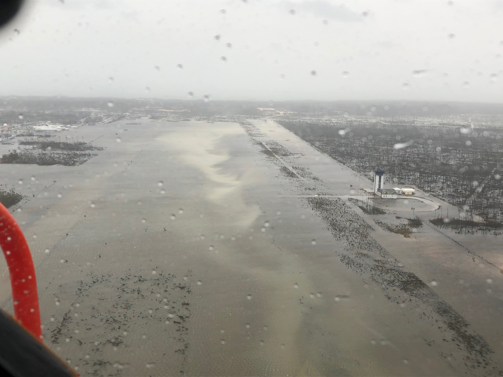
Marsh Harbour Airport after Hurricane Dorian, September 2019
- On 25 August 2001, American singer/actress Aaliyah and eight crew members of a group that had participated in the filming of her «Rock the Boat» music video, were killed soon after their plane took off from Marsh Harbour Airport. The plane was overloaded by 700 pounds (320 kg), according to its certification.
- On 13 June 2013, a SkyBahamas Airlines Saab 340B aircraft suffered substantial damage when it departed off the side of the runway while landing in heavy rain. There were no serious injuries or deaths among the 24 passengers and crew.
The above content comes from Wikipedia and is published under free licenses – click here to read more.
| General Info
|
| Country |
Bahamas, The
|
| ICAO ID |
MYAM
|
| Time |
UTC-5 (-4DT)
|
| Latitude |
26.511406
26° 30' 41.06" N
|
| Longitude |
-77.083472
077° 05' 00.50" W
|
| Elevation |
6 feet
2 meters
|
| Magnetic Variation |
007° W (05/06)
|
| Operating Agency |
CIVIL GOVERNMENT, (LANDING FEES AND DIPLOMATIC CLEARANCE MAY BE REQUIRED)
|
| Island Group |
Abaco I
|
| Operating Hours |
SUNRISE TO SUNSET (SR-SS)
|
| International Clearance Status |
Airport of Entry
|
| Daylight Saving Time |
Second Sunday in March at 0200 to first Sunday in November at 0200 local time (Exception Arizona and that portion of Indiana in the Eastern Time Zone)
|
| Communications
|
| UNICOM |
122.8
|
NASSAU RDO
Opr H24
|
124.2
|
FREEPORT APP
Opr H24
|
126.5
|
| Communications Remarks |
|
| RDO |
(RCO)
|
| Runways
|
| ID |
Dimensions |
Surface |
PCN |
ILS
|
| 09/27 |
4998 x 100 feet
1523 x 30 meters |
ASPHALT |
- |
NO
|
| Navaids
|
| Type |
ID |
Name |
Channel |
Freq |
Distance From Field |
Bearing From Navaid
|
| NDB |
ZMH |
MARSH HARBOUR |
- |
361 |
At Field |
-
|
| Supplies/Equipment
|
| Fuel |
100/130 octane gasoline, leaded, MIL-L-5572F (GREEN)
|
| Remarks
|
| FUEL |
( NC-100, A+)
|
| LGT |
PAPI Rwy 09-27 GS 3.25 .
|
| OPR HOURS |
Opr SR/SS.
|
The content above was published at Airports-Worldwide.com in 2020.
We don't guarantee the information is fresh and accurate. The data may be wrong or outdated.
For more up-to-date information please refer to other sources.
|
|