|
|
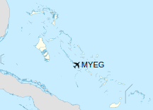
George Town Airport (ICAO: MYEG) is an airport located near George Town on the island of Great Exuma in The Bahamas which is closed for civilian use.
|
George Town Airport
|
|
|
| Summary |
| Airport type |
Public |
| Serves |
Great Exuma, Bahamas |
| Location |
George Town |
| Elevation AMSL |
5 ft / 2 m |
| Coordinates |
23°28′00″N
075°46′54″W |
| Map |
|
|
| Runways |
| Direction |
Length |
Surface |
| ft |
m |
| 11/29 |
|
1,524 |
Asphalt |
|
Facilities
The airport resides at an elevation of 5 ft (1.5 m) above mean sea level. It has one runway designated 11/29 with an asphalt surface measuring 1,524 m × 27 m (5,000 ft × 89 ft).
Accidents and incidents
- On 3 February 1998, Douglas C-47A N200MF of Missionary Flights International crashed on approach to George Town Airport. The aircraft was on a passenger flight from Cap-Haitien International Airport, Haiti when an engine failed shortly after take-off. The crew decided to return to George Town but the second engine failed on approach. All 26 on board survived.
The above content comes from Wikipedia and is published under free licenses – click here to read more.
| General Info
|
| Country |
Bahamas, The
|
| ICAO ID |
MYEG
|
| Time |
UTC-5 (-4DT)
|
| Latitude |
23.466667
23° 28' 00.00" N
|
| Longitude |
-75.781670
075° 46' 54.01" W
|
| Elevation |
5 feet
2 meters
|
| Magnetic Variation |
008° W (05/06)
|
| Operating Agency |
CIVIL GOVERNMENT, (LANDING FEES AND DIPLOMATIC CLEARANCE MAY BE REQUIRED)
|
| Island Group |
Exuma Island
|
| Operating Hours |
SUNRISE TO SUNSET (SR-SS)
|
| Daylight Saving Time |
Second Sunday in March at 0200 to first Sunday in November at 0200 local time (Exception Arizona and that portion of Indiana in the Eastern Time Zone)
|
| Communications
|
| UNICOM |
122.8
|
| NASSAU RDO |
124.2
|
| AWOS |
134.775
|
| Runways
|
| ID |
Dimensions |
Surface |
PCN |
ILS
|
| 11/29 |
5000 x 90 feet
1524 x 27 meters |
ASPHALT |
- |
NO
|
| Supplies/Equipment
|
| Fuel |
100/130 MIL Spec, low lead, aviation gasoline (BLUE)
|
| Remarks
|
| CAUTION |
Arpt open for offl use only.
|
| OPR HOURS |
Opr SR-SS.
|
The content above was published at Airports-Worldwide.com in 2020.
We don't guarantee the information is fresh and accurate. The data may be wrong or outdated.
For more up-to-date information please refer to other sources.
|
|