|
|
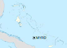
Duncan Town Airport (IATA: DCT, ICAO: MYRD) is an airport located near Duncan Town, on Ragged Island in The Bahamas.
|
Duncan Town Airport
|
|
|
| Summary |
| Airport type |
Public |
| Serves |
Ragged Island, Bahamas |
| Location |
Duncan Town |
| Elevation AMSL |
6 ft / 2 m |
| Coordinates |
22°10′54″N
075°43′46″W |
| Map |
|
|
| Runways |
| Direction |
Length |
Surface |
| m |
ft |
| 13/31 |
1,158 |
3,799 |
Asphalt |
|
Facilities
The airport resides at an elevation of 6 ft (1.8 m) above mean sea level. It has one runway designated 13/31 with an asphalt surface measuring 1,158 m × 23 m (3,799 ft × 75 ft).
The above content comes from Wikipedia and is published under free licenses – click here to read more.
| General Info
|
| Country |
Bahamas, The
|
| ICAO ID |
MYRD
|
| Time |
UTC-5 (-4DT)
|
| Latitude |
22.181803
22° 10' 54.49" N
|
| Longitude |
-75.729456
075° 43' 46.04" W
|
| Elevation |
6 feet
2 meters
|
| Magnetic Variation |
007° W (05/06)
|
| Operating Agency |
CIVIL GOVERNMENT, (LANDING FEES AND DIPLOMATIC CLEARANCE MAY BE REQUIRED)
|
| Island Group |
Ragged I
|
| Operating Hours |
SUNRISE TO SUNSET (SR-SS)
|
| Daylight Saving Time |
Second Sunday in March at 0200 to first Sunday in November at 0200 local time (Exception Arizona and that portion of Indiana in the Eastern Time Zone)
|
| Runways
|
| ID |
Dimensions |
Surface |
PCN |
ILS
|
| 13/31 |
3800 x 75 feet
1158 x 23 meters |
ASPHALT |
- |
NO
|
| Remarks
|
| OPR HOURS |
Opr SR-SS.
|
The content above was published at Airports-Worldwide.com in 2020.
We don't guarantee the information is fresh and accurate. The data may be wrong or outdated.
For more up-to-date information please refer to other sources.
|
|