|
|
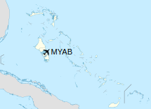
Clarence A. Bain Airport (IATA: MAY, ICAO: MYAB) is an airport serving Mangrove Cay, part of Andros Island in The Bahamas.
|
Clarence A. Bain Airport
|
|
|
| Summary |
| Airport type |
Public |
| Operator |
Government |
| Location |
Mangrove Cay, Andros Island, Bahamas |
| Elevation AMSL |
19 ft / 6 m |
| Coordinates |
24°17′16″N
077°41′05″W |
| Map |
|
|
| Runways |
| Direction |
Length |
Surface |
| m |
ft |
| 09/27 |
1,524 |
5,000 |
Asphalt |
|
Facilities
The airport resides at an elevation of 19 ft (5.8 m) above mean sea level. It has one runway designated 09/27 with an asphalt surface measuring 1,524 m × 23 m (5,000 ft × 75 ft).
Airlines and destinations
| Destinations |
| Western Air |
Nassau |
The above content comes from Wikipedia and is published under free licenses – click here to read more.
| General Info
|
| Country |
Bahamas, The
|
| ICAO ID |
MYAB
|
| Time |
UTC-5 (-4DT)
|
| Latitude |
24.287664
24° 17' 15.59" N
|
| Longitude |
-77.684614
077° 41' 04.61" W
|
| Elevation |
19 feet
6 meters
|
| Magnetic Variation |
007° W (05/06)
|
| Operating Agency |
CIVIL GOVERNMENT, (LANDING FEES AND DIPLOMATIC CLEARANCE MAY BE REQUIRED)
|
| Island Group |
Andros I
|
| Operating Hours |
SUNRISE TO SUNSET (SR-SS)
|
| Daylight Saving Time |
Second Sunday in March at 0200 to first Sunday in November at 0200 local time (Exception Arizona and that portion of Indiana in the Eastern Time Zone)
|
| Runways
|
| ID |
Dimensions |
Surface |
PCN |
ILS
|
| 09/27 |
5000 x 75 feet
1524 x 23 meters |
BITUMINOUS, TAR OR ASPHALT MIXED IN PLACE, OILED. |
- |
NO
|
| Remarks
|
| CAUTION |
Ridges on Rwy 09-27 shoulders.
|
| OPR HOURS |
Opr SR-SS.
|
The content above was published at Airports-Worldwide.com in 2020.
We don't guarantee the information is fresh and accurate. The data may be wrong or outdated.
For more up-to-date information please refer to other sources.
|
|