|
 History - Chronicle
100 years ago courageous men, pioneers of aviation from the region of
Carinthia were starting with their flying.
Already in 1905 Georg Count of Khevenh?ller from Hochosterwitz Castle
and in 1907 Dipl.-Ing. Josef Sablatnig (Josef Sablatnig was owner of the
Fokker-Sablatnig, Deutsche Flugzeuge, Deutsche Motoren, Flugzeug Gesellschaft
mbH, Berlin) were the first men in the sky over Carinthia and Klagenfurt.
In World War I and II the airport of Klagenfurt was operated as a Military
Airfield, and indeed Klagenfurt Airport was founded in 1914 as a military
airport. The civil opening of Klagenfurt Airport on May 17th, 1925 was
an event for the City of Klagenfurt as well as for Carinthia.
Already in the years 1926 to 1938 seven airlines operated from Klagenfurt
airport. Countries like Germany, Italy, Slovenia and of course domestic
flights to all major cities in Austria were connected with Klagenfurt.
After 1950 the Airport was connected with countries like Brazil, Israel,
Venezuela, Netherlands, Germany United Kingdom and others.
Technical
Information
Total Airport Area: Approx. 200 hectares
Apron:
Area: 70.000 m?
Parking Positions: 7 medium range Aircraft,
6 General Aviation - Aircraft
Runway:
1x Concrete Surface Runway 10/28
2.720 x 45 m
Area: 188.000 m? incl. Taxiways
Durability: PCN 37,5/R/B/W/T
Precision Approach System: ILS CAT II/III
1 x Grass Runway 10/28
710 x 25 m
Durability: AUW 2000 kg
1 x Glider Landing Area 10/28
300 x 20 m
Durability: AUW 2000 kg
Buildings
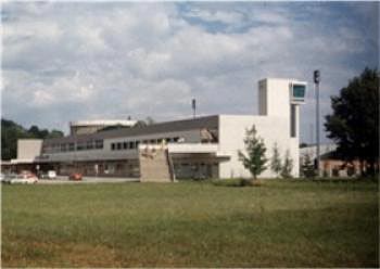
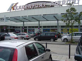
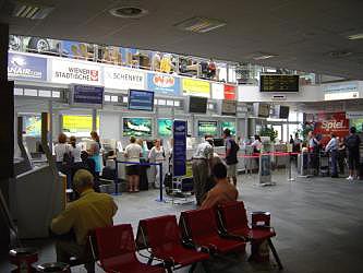
Terminal Building :
Length: 225m, Floor Area: 5.270 m?
Hangar 1:
102 m long x 49 m wide, Floor Area 4.998 m?
Hangar 2:
94 m long x 49 m wide, Floor Area 4.606 m?
Equipment Hangar:
90 m long x 30 m wide, Floor Area 2.700 m?
Fire Station:
29 m long x 13 m wide, Floor Area 377 m?
Fuel
Provision & Supply
Shell Austria AG – Aircraft Fueling Service www.shell.com/aviation
Tel.: +43 / (0) 463 / 481866
Mobil.: +43 / (0) 463 / 41500 – 350
Fax.: +43 / (0) 463 / 481867
Opening Hours :
Daily 05.30 – 20.00 Hours (Local Time)
Extension Available on Request
Fuel Storage:
Jet A1 (Kerosin):
2 x 100.000 Litre Underground Tanks
AVGAS 100LL (Aircraft Fuel):
1 Underground Tank Capacity: 50.000 ltr
Trucks:
Tankers for Jet A1: Capacity: 37.000 ltr. bzw. 24.000 ltr.
Tanker for AVGAS 100 LL: Capacity: 7.000 ltr. bzw. 1.500 ltr.
Lubricants & Oil: Aeroshell 15W50
Address:
A-9020 Klagenfurt-Flughafen
Flughafenstrasse 60-64
Telefon +43 (463) 41 500
Telefax +43 (463) 41 500-236
E-mail: office at klagenfurt-airport at
http://www.klagenfurt-airport at /
Images and information placed above are from
http://www.klagenfurt-airport at /
We thank them for the data!
| General Info
|
| Country |
Austria
|
| ICAO ID |
LOXK, LOWK
|
| Time |
UTC+1(+2DT)
|
| Latitude |
46.642514
46° 38' 33.05" N
|
| Longitude |
14.337739
014° 20' 15.86" E
|
| Elevation |
1470 feet
448 meters
|
| Type |
Joint (Civil and Military)
|
| Magnetic Variation |
002° E (05/06)
|
| Operating Agency |
MILITARY
|
| Alternate Name |
WORTHERSEE INTL
|
| Operating Hours |
SEE REMARKS FOR OPERATING HOURS OR COMMUNICATIONS FOR POSSIBLE HOURS
|
| International Clearance Status |
Airport of Entry
|
| Daylight Savings Time |
Last Sunday in March to last Sunday in October
|
| Communications
|
TWR
Opr 0445-2245Z++
|
118.1
|
ATIS
Opr 0445-2245Z++
|
124.075
|
APP
Opr 0445-2245Z++
|
126.825
|
| Runways
|
| ID |
Dimensions |
Surface |
PCN |
ILS
|
| 10R/28L |
2427 x 90 feet
740 x 27 meters |
GRASS OR EARTH NOT GRADED OR ROLLED. |
- |
NO
|
| 10L/28R |
8924 x 148 feet
2720 x 45 meters |
CONCRETE. |
037RBWT |
YES
|
| Navaids
|
| Type |
ID |
Name |
Channel |
Freq |
Distance From Field |
Bearing From Navaid
|
| VOR-DME |
KFT |
KLAGENFURT |
078X |
113.1 |
9.7 NM |
285.3
|
| NDB |
KW |
KLAGENFURT |
- |
405 |
5.2 NM |
104.9
|
| Supplies/Equipment
|
| Fuel |
Jet A1, without icing nhibitor.
100/130 MIL Spec, low lead, aviation gasoline (BLUE)
|
| Other Fluids |
DE-ICE, Anti-icing/De-icing/Defrosting Fluid (MIL A 8243)
|
| Remarks
|
| CAUTION |
Storks at afld, especially apch sctr Rwy 10.
|
| FLUID |
De-icing veh.
|
| FUEL |
Avbl 0430-1900Z++, OT PN. (NC-100LL, A1)
|
| LGT |
PAPI Rwy 10 GS 3.5 .
|
| NS ABTMT |
Land Rwy 28R, tkof Rwy 10L if practicable.
|
| OPR HOURS |
Opr 0500-2230Z++.
|
Runway 10R/28L
2427 x 90 feet
740 x 27 meters
| Runway 10R
|
| Surface |
GRASS OR EARTH NOT GRADED OR ROLLED.
|
| True Heading |
106.0
|
| Latitude |
46.644119
46° 38' 38.83" N
|
| Longitude |
14.320169
014° 19' 12.61" E
|
| Elevation |
1470.0 feet
448 meters
|
| Slope |
-0.3°
|
| Landing Distance |
2231 feet
680 meters
|
| Takeoff Distance |
2427 feet
740 meters
|
| Displaced Threshold Length |
196 feet
60 meters
|
| Runway 28L
|
| Surface |
GRASS OR EARTH NOT GRADED OR ROLLED.
|
| True Heading |
286.0
|
| Latitude |
46.642314
46° 38' 32.33" N
|
| Longitude |
14.329086
014° 19' 44.71" E
|
| Elevation |
1463.0 feet
446 meters
|
| Slope |
0.3°
|
| Landing Distance |
2231 feet
680 meters
|
| Takeoff Distance |
2427 feet
740 meters
|
| Displaced Threshold Length |
196 feet
60 meters
|
Runway 10L/28R
8924 x 148 feet
2720 x 45 meters
| Runway 10L
|
| Surface |
CONCRETE.
|
| True Heading |
106.0
|
| Latitude |
46.645944
46° 38' 45.40" N
|
| Longitude |
14.320686
014° 19' 14.47" E
|
| Elevation |
1470.0 feet
448 meters
|
| Slope |
-0.3°
|
| Landing Distance |
8268 feet
2520 meters
|
| Takeoff Distance |
8924 feet
2720 meters
|
| Displaced Threshold Length |
656 feet
200 meters
|
| Lighting System |
CL
HIRL
A3
PAPI |
| Runway 28R
|
| Surface |
CONCRETE.
|
| True Heading |
286.0
|
| Latitude |
46.639083
46° 38' 20.70" N
|
| Longitude |
14.354789
014° 21' 17.24" E
|
| Elevation |
1445.0 feet
440 meters
|
| Slope |
0.3°
|
| Landing Distance |
8924 feet
2720 meters
|
| Takeoff Distance |
8924 feet
2720 meters
|
| Lighting System |
SF
CL
HIRL
REIL
A
PAPI |
Navaids
| KLAGENFURT
|
| Type |
ID |
Channel |
Freq |
Country |
State
|
| VOR-DME |
KFT |
078X |
113.1 |
Austria |
-
|
| Latitude |
Longitude |
Airport
|
46.597583
46° 35' 51.30" N |
14.562319
014° 33' 44.35" E |
LOXK |
Navaids
| KLAGENFURT
|
| Type |
ID |
Channel |
Freq |
Country |
State
|
| NDB |
KW |
- |
405 |
Austria |
-
|
| Latitude |
Longitude |
Airport
|
46.667475
46° 40' 02.91" N |
14.218253
014° 13' 05.71" E |
LOXK |
The content above was published at Airports-Worldwide.com in 2006.
We don't guarantee the information is fresh and accurate. The data may be wrong or outdated.
For more up-to-date information please refer to other sources.
|


