 |
 |
|
||||
|
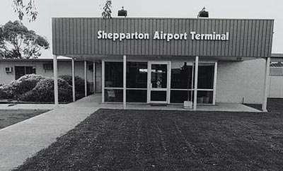
Images and information placed above are from http://nla.gov.au/nla.pic-an11386879-31 http://www.shepparton.vic.gov.au/home/guide/3582 We thank them for the data!
Runway 09/27 1388 x 98 feet
|
|||||||||||||||||||||||||||||||||||||||||||||||||||||||||||||||||||||||||||||||||||||||||||||||||||||||||||||||||||||||||||||||||||||||||||||||||||||||||||||||||||||||||||||||||||||||||||||||||||||||||||||||||||||||||||||||
| Runway 09 | |
|---|---|
| Surface | GRAVEL. |
| True Heading | 098.0 |
| Latitude | -36.429497 36° 25' 46.19" S |
| Longitude | 145.390853 145° 23' 27.07" E |
| Elevation | 374.0 feet 114 meters |
| Slope | 0.0° |
| Landing Distance | 1388 feet 423 meters |
| Takeoff Distance | 1388 feet 423 meters |
| Runway 27 | |
|---|---|
| Surface | GRAVEL. |
| True Heading | 278.0 |
| Latitude | -36.430042 36° 25' 48.15" S |
| Longitude | 145.395614 145° 23' 44.21" E |
| Elevation | 374.0 feet 114 meters |
| Slope | 0.0° |
| Landing Distance | 1388 feet 423 meters |
| Takeoff Distance | 1388 feet 423 meters |
| Runway 18 | |
|---|---|
| Surface | ASPHALT |
| True Heading | 192.0 |
| Latitude | -36.420897 36° 25' 15.23" S |
| Longitude | 145.393247 145° 23' 35.69" E |
| Elevation | 374.0 feet 114 meters |
| Slope | 0.0° |
| Landing Distance | 4062 feet 1238 meters |
| Takeoff Distance | 4521 feet 1378 meters |
| Displaced Threshold Length | 459 feet 140 meters |
| Lighting System | PCL
LIRL PAPI PORTABLE |
| Runway 36 | |
|---|---|
| Surface | ASPHALT |
| True Heading | 012.0 |
| Latitude | -36.433106 36° 25' 59.18" S |
| Longitude | 145.390436 145° 23' 25.57" E |
| Elevation | 373.0 feet 114 meters |
| Slope | 0.0° |
| Landing Distance | 4029 feet 1228 meters |
| Takeoff Distance | 4521 feet 1378 meters |
| Displaced Threshold Length | 492 feet 150 meters |
| Lighting System | PCL
LIRL PAPI PORTABLE |
| SHEPPARTON | |||||
|---|---|---|---|---|---|
| Type | ID | Channel | Freq | Country | State |
| NDB | SHT | - | 212 | Australia | - |
| Latitude | Longitude | Airport |
| -36.428361 36° 25' 42.10" S |
145.396022 145° 23' 45.68" E |
YSHT |
The content above was published at Airports-Worldwide.com in 2004-2006.
We don't guarantee the information is fresh and accurate. The data may be wrong or outdated.
For more up-to-date information please refer to other sources.

 |
|
Copyright 2004-2024 © by Airports-Worldwide.com, Vyshenskoho st. 36, Lviv 79010, Ukraine Legal Disclaimer |
 Operator: City of Greater Shepparton