 |
 |
|
||||
|
About Rockhampton Airport The Rockhampton City Council owns and operates the Rockhampton Airport. Early in 2000 the Airport runway was extended and associated pavements upgraded, resulting in the ability to accommodate unrestricted wide-bodied operations. The Airport is now used by both domestic and international airlines using a mix of wide-bodied aircraft including the B747 to B777 and A340 types. 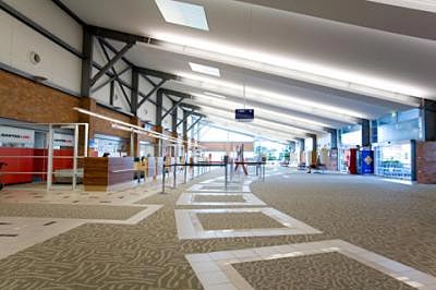
It is expected that facilities will be expanded to accommodate a new customs quarantine section for future international flights. With this comes the opportunity of increased tourism. Information regarding flight arrivals and departures should be directed to the relevant airlines, however for any information relating to the Airport, please contact the Airport Management Office on 4936 8314. 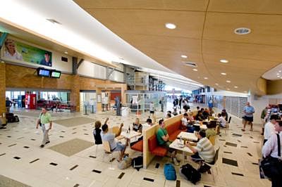
Airport History Efforts to locate a permanent aerodrome site in the city had been proceeding for a number of years in the 1920's. The City Council and the Federal Government, however, could not come to an arrangement as to a suitable site. Prior to 1930, a number of locations within the city had been used for the operation of aircraft, all on a non official basis and none suitable for long term use. In 1929, the lease to a former racecourse, Connor Park, was acquired by a number of aspiring aviators, and they set about making it suitable for aircraft. 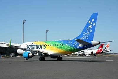
The Rockhampton Aero Club was formed on February 9, 1930, and announced that flying training would commence at the location. The aerodrome was officially opened as Connor Park Aerodrome on March 2, 1930. A few weeks later, the aerodrome was again officially opened as Rockhampton Aerodrome, and the first passenger aircraft, a Fokker monoplane, Star of Cairns, landed. During World War II, facilities at the airport were substantially upgraded. The Commonwealth took over control of the airport, and the Royal Australian Air Force moved in. An Aeradio station was established to enable air ground communication, a facility that survived as a Flight Service Unit until 1992. 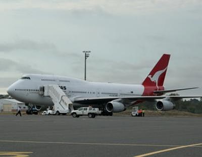
Control Tower facilities were also established. At one stage, work was commenced to allow rapid demolition of the runways if required. In 1987 during upgrade work, the demolition tunnels were located and removed. In February 1989, the Rockhampton City Council was vested with ownership of the airport. With the completion of the AU$8.4m Terminal Redevelopment Project, Rockhampton Airport is now well placed to accommodate future passenger growth. 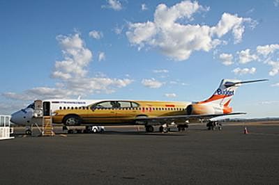
Contacts: Rockhampton Airport Management Phone: +61 (07) 4936 8314 Email: enquiries at rcc qld gov au URL: http://www.rockhampton.qld gov au/airport/ 
Rockhampton is only 30 minutes from the Capricorn Coast and is regarded as the Gateway to Central Queensland. The Fitzroy River and the Berserker Ranges, including Mount Archer, are two of the City's most prominent landmarks. Rockhampton is regarded as the Beef Capital of Australia, and is also situated within close proximity to Australia's largest coal producing region, the Bowen Basin. Images and information placed above are from http://www.rockhampton.qld gov au/airport/ We thank them for the data!
Runway 04/22 5397 x 98 feet
|
|||||||||||||||||||||||||||||||||||||||||||||||||||||||||||||||||||||||||||||||||||||||||||||||||||||||||||||||||||||||||||||||||||||||||||||||||||||||||||||||||||||||||||||||||||||||||||||||||||||||||||||||||||||||||||||||||||||||||||||||||||||||||||||||||||||||||||||||||
| Runway 04 | |
|---|---|
| Surface | ASPHALT |
| True Heading | 053.0 |
| Latitude | -23.382458 23° 22' 56.85" S |
| Longitude | 150.465389 150° 27' 55.40" E |
| Elevation | 31.0 feet 9 meters |
| Slope | 0.0° |
| Landing Distance | 5397 feet 1645 meters |
| Takeoff Distance | 5397 feet 1645 meters |
| Lighting System | PCL
MIRL |
| Runway 22 | |
|---|---|
| Surface | ASPHALT |
| True Heading | 233.0 |
| Latitude | -23.373397 23° 22' 24.23" S |
| Longitude | 150.478158 150° 28' 41.37" E |
| Elevation | 32.0 feet 10 meters |
| Slope | 0.0° |
| Landing Distance | 5397 feet 1645 meters |
| Takeoff Distance | 5397 feet 1645 meters |
| Lighting System | PCL
MIRL |
| Runway 15 | |
|---|---|
| Surface | ASPHALT |
| True Heading | 158.0 |
| Latitude | -23.368717 23° 22' 07.38" S |
| Longitude | 150.470350 150° 28' 13.26" E |
| Elevation | 33.0 feet 10 meters |
| Slope | -0.1° |
| Landing Distance | 8622 feet 2628 meters |
| Takeoff Distance | 8622 feet 2628 meters |
| Lighting System | PCL
MIRL PAPI |
| Runway 33 | |
|---|---|
| Surface | ASPHALT |
| True Heading | 338.0 |
| Latitude | -23.390681 23° 23' 26.45" S |
| Longitude | 150.480117 150° 28' 48.42" E |
| Elevation | 27.0 feet 8 meters |
| Slope | 0.1° |
| Landing Distance | 8622 feet 2628 meters |
| Takeoff Distance | 8622 feet 2628 meters |
| Lighting System | PCL
MIRL PAPI |
| ROCKHAMPTON | |||||
|---|---|---|---|---|---|
| Type | ID | Channel | Freq | Country | State |
| NDB | RK | - | 257 | Australia | - |
| Latitude | Longitude | Airport |
| -23.370833 23° 22' 15.00" S |
150.475278 150° 28' 31.00" E |
YBRK |
| ROCKHAMPTON | |||||
|---|---|---|---|---|---|
| Type | ID | Channel | Freq | Country | State |
| VOR-DME | RK | 116X | 116.9 | Australia | - |
| Latitude | Longitude | Airport |
| -23.382778 23° 22' 58.00" S |
150.471667 150° 28' 18.00" E |
YBRK |
The content above was published at Airports-Worldwide.com in 2004-2006.
We don't guarantee the information is fresh and accurate. The data may be wrong or outdated.
For more up-to-date information please refer to other sources.

 |
|
Copyright 2004-2025 © by Airports-Worldwide.com, Vyshenskoho st. 36, Lviv 79010, Ukraine Legal Disclaimer |