 |
|
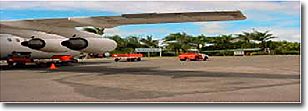
Proserpine/Whitsunday Airport |
|
|
 Address:
PO Box 104
Proserpine QLD 4800
Australia
Lying close to the beautiful Whitsunday resort area, Proserpine is the business centre for the Whitsundays, Airlie Beach and Shutehaven. Tourism also plays a major role in the area, with visitors arriving to stay a while or pass through on their way to the Great Barrier Reef. Proserpine is the closest major airport to the Whitsundays, a tropical haven for young and old.
Located ten minutes drive from the rural centre of Proserpine and thirty minutes drive from the popular mainland beach resort town of Airlie Beach is the Whitsunday Coast Airport.
Jetstar, a subsidiary company of Qantas currently services the Whitsunday region on a once-daily basis with direct flights from Brisbane. Connections to southern ports (e.g. Sydney and Melbourne) are also available through Brisbane to the Whitsundays.
Bookings can be made through any Jetstar booking office or accredited travel agent.
Virgin Airlines currently provide a direct flight from both Sydney and Melbourne to Proserpine every Saturday. Virgin Airlines also provide a daily direct service from Brisbane. Negotiations are underway to increase the number of services. Bookings can be made via the internet.
Upon arrival at the Whitsunday Coast Airport, air-conditioned coaches or taxi services will transport you through the rural tropical environment of the Whitsundays to your destination choice of Proserpine, mainland Airlie Beach or perhaps Shute Harbour... the major transit point for Whitsunday Islands.
URL: Proserpine/Whitsunday Airport
Images and information placed above are from
Proserpine/Whitsunday
Airport
We thank them for the data!
| General Info
|
| Country |
Australia
|
| ICAO ID |
YBPN
|
| Time |
UTC+10
|
| Latitude |
-20.495000
20° 29' 42.00" S
|
| Longitude |
148.552222
148° 33' 08.00" E
|
| Elevation |
82 feet
25 meters
|
| Magnetic Variation |
008° E (01/04)
|
| Operating Agency |
CIVIL GOVERNMENT, (LANDING FEES AND DIPLOMATIC CLEARANCE MAY BE REQUIRED)
|
| Communications
|
| MTAF |
126.7
|
| BRISBANE CNTR |
135.5
|
| Communications Remarks |
|
| FSS |
(on gnd)
|
| MISC |
Nstd wi 15 NM rad Proserpine Whitsunday Coast arpt and 22 DME Hamilton Island and 15 NM rad S19 48' E149 17'excluding Hamilton Island Class D airspace during twr hrs.
|
| Runways
|
| ID |
Dimensions |
Surface |
PCN |
ILS
|
| 06/24 |
3609 x 98 feet
1100 x 30 meters |
ASPHALT |
- |
NO
|
| 11/29 |
6801 x 148 feet
2073 x 45 meters |
ASPHALT |
053FBYT |
NO
|
| Navaids
|
| Type |
ID |
Name |
Channel |
Freq |
Distance From Field |
Bearing From Navaid
|
| VOR-DME |
PN |
PROSERPINE |
084X |
113.7 |
At Field |
-
|
| NDB |
PN |
PROSERPINE |
- |
245 |
At Field |
-
|
| Supplies/Equipment
|
| Fuel |
Jet A1, without icing nhibitor.
100/130 MIL Spec, low lead, aviation gasoline (BLUE)
|
| Oil |
O-117, 1100, Reciprocating Engine Oil (MIL L 6082)
O-128, 1100,(Dispersant)Reciprocating Engine Oil(MIL L 22851 Type II)
|
| Remarks
|
| CAUTION |
Bird and kangaroo haz. PJE act SR-SS up to 10,000'.
|
| FUEL |
Avbl 0000-0500Z dly, OT PPR fone C07-49451774. (NC-A1)
|
| LGT |
ACTIVATE-Rwy 11-29-120.6. Portable emerg lgt PN RWY 06-24. Portable emerg lgt RWY 11-29 fone C04-1776-2235.
|
| MISC |
Ldg fees.
|
| OIL |
O-117, 0-128
|
| RSTD |
Rwy 06-24 not avbl for acft abv 12,500 lbs. OPS only on paved surfaces.
|
Runway 06/24
3609 x 98 feet
1100 x 30 meters
| Runway 06
|
| Surface |
ASPHALT
|
| True Heading |
067.0
|
| Latitude |
-20.493314
20° 29' 35.93" S
|
| Longitude |
148.556625
148° 33' 23.85" E
|
| Elevation |
70.0 feet
21 meters
|
| Slope |
0.2°
|
| Landing Distance |
3609 feet
1100 meters
|
| Takeoff Distance |
3609 feet
1100 meters
|
| Lighting System |
PORTABLE
|
| Runway 24
|
| Surface |
ASPHALT
|
| True Heading |
247.0
|
| Latitude |
-20.489481
20° 29' 22.13" S
|
| Longitude |
148.566364
148° 33' 58.91" E
|
| Elevation |
77.0 feet
23 meters
|
| Slope |
-0.2°
|
| Landing Distance |
3609 feet
1100 meters
|
| Takeoff Distance |
3609 feet
1100 meters
|
| Lighting System |
PORTABLE
|
Runway 11/29
6801 x 148 feet
2073 x 45 meters
| Runway 11
|
| Surface |
ASPHALT
|
| True Heading |
114.0
|
| Latitude |
-20.490489
20° 29' 25.76" S
|
| Longitude |
148.544419
148° 32' 39.91" E
|
| Elevation |
58.0 feet
18 meters
|
| Slope |
-0.2°
|
| Landing Distance |
6801 feet
2073 meters
|
| Takeoff Distance |
6801 feet
2073 meters
|
| Lighting System |
PCL
LIRL
REIL
VA
PORTABLE |
| Runway 29
|
| Surface |
ASPHALT
|
| True Heading |
294.0
|
| Latitude |
-20.498253
20° 29' 53.71" S
|
| Longitude |
148.562508
148° 33' 45.03" E
|
| Elevation |
47.0 feet
14 meters
|
| Slope |
0.2°
|
| Landing Distance |
6801 feet
2073 meters
|
| Takeoff Distance |
6801 feet
2073 meters
|
| Lighting System |
PCL
LIRL
VA
PORTABLE |
Navaids
| PROSERPINE
|
| Type |
ID |
Channel |
Freq |
Country |
State
|
| NDB |
PN |
- |
245 |
Australia |
-
|
| Latitude |
Longitude |
Airport
|
-20.489167
20° 29' 21.00" S |
148.559444
148° 33' 34.00" E |
YBPN
|
| PROSERPINE
|
| Type |
ID |
Channel |
Freq |
Country |
State
|
| VOR-DME |
PN |
084X |
113.7 |
Australia |
-
|
| Latitude |
Longitude |
Airport
|
-20.496667
20° 29' 48.00" S |
148.552778
148° 33' 10.00" E |
YBPN
|
The content above was published at Airports-Worldwide.com in 2004-2006.
We don't guarantee the information is fresh and accurate. The data may be wrong or outdated.
For more up-to-date information please refer to other sources.
|
 |


