 |
|
|
|
|
|
 Operator: Shire of Carpenteria
Address:
PO Box 31
Normanton QLD 4890
Australia
Phone: +61 7 47451166
Fax: +61 7 47451340
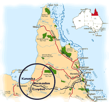
Normanton sits on a high, sandy ridge between the edge of the Savannah grasslands which extend to the West and the wetlands extending to the north. Established on the Norman River by William Landsborough, Normanton was the port for the Croydon gold rush and is a terminus of the historic Normanton to Croydon Railway with a classic example of Victorian architecture preserved in the Normanton Railway Station.
The Gulf Savannah region extends from the Great Dividing Range in the east to the Northern Territory border in the west. The Gulf Savannah region is a safari country of golden savannah grasslands abounding with wildlife. Established on the Norman River by William Landsborough, Normanton was the port for the Croydon Rush and is a terminus of the Victorian architecture preserved in the Normanton Railway Station. Some 30 kilometres to the south-west of Normanton is camp 119, Burke and Wills' most northerly camp. The wetlands between Normanton and Karumba are also excellent for birdwatching, particularly just after the 'wet season'.
Distance From Brisbane (State Capital): 2,500 kilometres north
Images and information placed above are from
www.airportsaustralia.com
We thank them for the data!
| General Info
|
| Country |
Australia
|
| ICAO ID |
YNTN
|
| Time |
UTC+10
|
| Latitude |
-17.683611
17° 41' 01.00" S
|
| Longitude |
141.070278
141° 04' 13.00" E
|
| Elevation |
73 feet
22 meters
|
| Magnetic Variation |
006° E (01/04)
|
| Operating Agency |
CIVIL GOVERNMENT, (LANDING FEES AND DIPLOMATIC CLEARANCE MAY BE REQUIRED)
|
| Communications
|
| BRISBANE CNTR |
118.6
|
| CTAF |
126.7
|
| Communications Remarks |
|
| FSS |
(on gnd)
|
| Runways
|
| ID |
Dimensions |
Surface |
PCN |
ILS
|
| 14/32 |
5499 x 98 feet
1676 x 30 meters |
ASPHALT |
008FAYU |
NO
|
| Navaids
|
| Type |
ID |
Name |
Channel |
Freq |
Distance From Field |
Bearing From Navaid
|
| NDB |
NTN |
NORMANTON |
- |
311 |
At Field |
-
|
| Supplies/Equipment
|
| Fuel |
Jet A1, without icing nhibitor.
100/130 MIL Spec, low lead, aviation gasoline (BLUE)
|
| Oil |
O-156, MIL L 23699 (Synthetic Base)Turboprop/Turboshaft Engine
|
| Remarks
|
| FUEL |
Avbl 2200-0700Z Mon-Fri exc hol, OT 1 hr PN, fone C 07 47451615. (NC-100LL, A1)
|
| LGT |
ACTIVATE-121.3.
|
| MISC |
Ldg fees.
|
| OIL |
O156
|
Runway 14/32
5499 x 98 feet
1676 x 30 meters
| Runway 14
|
| Surface |
ASPHALT
|
| True Heading |
147.0
|
| Latitude |
-17.680822
17° 40' 50.96" S
|
| Longitude |
141.067478
141° 04' 02.92" E
|
| Elevation |
28.0 feet
9 meters
|
| Slope |
0.8°
|
| Landing Distance |
5499 feet
1676 meters
|
| Takeoff Distance |
5499 feet
1676 meters
|
| Lighting System |
PCL
LIRL |
| Runway 32
|
| Surface |
ASPHALT
|
| True Heading |
327.0
|
| Latitude |
-17.693458
17° 41' 36.45" S
|
| Longitude |
141.076197
141° 04' 34.31" E
|
| Elevation |
72.0 feet
22 meters
|
| Slope |
-0.8°
|
| Landing Distance |
5499 feet
1676 meters
|
| Takeoff Distance |
5499 feet
1676 meters
|
| Lighting System |
PCL
LIRL |
Navaids
| NORMANTON
|
| Type |
ID |
Channel |
Freq |
Country |
State
|
| NDB |
NTN |
- |
311 |
Australia |
-
|
| Latitude |
Longitude |
Airport
|
-17.695833
17° 41' 45.00" S |
141.073056
141° 04' 23.00" E |
YNTN
|
The content above was published at Airports-Worldwide.com in 2004-2006.
We don't guarantee the information is fresh and accurate. The data may be wrong or outdated.
For more up-to-date information please refer to other sources.
|
 |


