 |
 |
|
||||
|
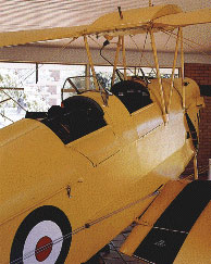
Images and information placed above are from www.airportsaustralia.com We thank them for the data!
3346 x 98 feet
|
|||||||||||||||||||||||||||||||||||||||||||||||||||||||||||||||||||||||||||||||||||||||||||||||||||||||||||||||||||||||||||||||||||||||||||||||||||||||||||||||||||||||||||||||||||||||||||||||||||||||||||||||||||||||||||||||||||||||||||||||||||||||
| Runway 05 | |
|---|---|
| Surface | GRAVEL. |
| True Heading | 053.0 |
| Latitude | -34.703697 34° 42' 13.31" S |
| Longitude | 146.508981 146° 30' 32.33" E |
| Elevation | 471.0 feet 144 meters |
| Slope | -0.1° |
| Landing Distance | 3346 feet 1020 meters |
| Takeoff Distance | 3346 feet 1020 meters |
| Runway 23 | |
|---|---|
| Surface | GRAVEL. |
| True Heading | 233.0 |
| Latitude | -34.698128 34° 41' 53.26" S |
| Longitude | 146.518008 146° 31' 04.83" E |
| Elevation | 469.0 feet 143 meters |
| Slope | 0.1° |
| Landing Distance | 3346 feet 1020 meters |
| Takeoff Distance | 3346 feet 1020 meters |
Runway 14/32
| Runway 14 | |
|---|---|
| Surface | ASPHALT |
| True Heading | 144.0 |
| Latitude | -34.693347 34° 41' 36.05" S |
| Longitude | 146.505483 146° 30' 19.74" E |
| Elevation | 469.0 feet 143 meters |
| Slope | 0.0° |
| Landing Distance | 5302 feet 1616 meters |
| Takeoff Distance | 5302 feet 1616 meters |
| Lighting System | PCL
LIRL |
| Runway 32 | |
|---|---|
| Surface | ASPHALT |
| True Heading | 324.0 |
| Latitude | -34.705078 34° 42' 18.28" S |
| Longitude | 146.515858 146° 30' 57.09" E |
| Elevation | 470.0 feet 143 meters |
| Slope | 0.0° |
| Landing Distance | 5302 feet 1616 meters |
| Takeoff Distance | 5302 feet 1616 meters |
| Lighting System | PCL
LIRL |
| NARRANDERA | |||||
|---|---|---|---|---|---|
| Type | ID | Channel | Freq | Country | State |
| NDB | NAR | - | 329 | Australia | - |
| Latitude | Longitude | Airport |
| -34.707072 34° 42' 25.46" S |
146.512878 146° 30' 46.36" E |
YNAR |
| NARRANDERA | |||||
|---|---|---|---|---|---|
| Type | ID | Channel | Freq | Country | State |
| VOR-DME | NAR | 110X | 116.3 | Australia | - |
| Latitude | Longitude | Airport |
| -34.701944 34° 42' 07.00" S |
146.516944 146° 31' 01.00" E |
YNAR |
The content above was published at Airports-Worldwide.com in 2004-2006.
We don't guarantee the information is fresh and accurate. The data may be wrong or outdated.
For more up-to-date information please refer to other sources.

 |
|
Copyright 2004-2024 © by Airports-Worldwide.com, Vyshenskoho st. 36, Lviv 79010, Ukraine Legal Disclaimer |
 Operator: Narrandera Shire Council