|
Margaret River
is 300km south of Perth and is accessible in a variety of ways, including
by car, bus, air and train.
By air:
Margaret River is serviced by Air Australia. It is a charter service and
the cost varies depending on the number of people travelling.
Bookings and inquiries may be made through Margaret River Holidays.
By train:
The Australind train makes daily trips to Bunbury from Perth. It connects
with the Westrail bus service that takes passengers south through Margaret
River.
Car Hire:
You may hire small cars and 4wd vehicles in Margaret River at Escape Car
Rentals.
|
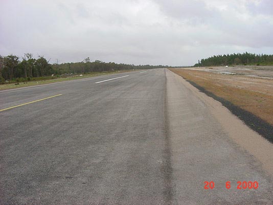
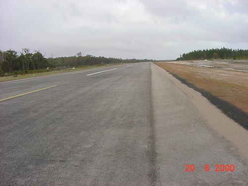 |
Photo credit: Transport (WA Govt)
(Click on the photo to enlarge) |
|
 |
Photo credit: Transport (WA Govt)
(Click on the photo to enlarge) |
Images and information placed above are from
http://www.flightclub.com.au/wa-airstrips/margaretriver/
We thank them for the data!
| General Info
|
| Country |
Australia
|
| ICAO ID |
YMGT
|
| Time |
UTC+8
|
| Latitude |
-33.930556
33° 55' 50.00" S
|
| Longitude |
115.100000
115° 06' 00.00" E
|
| Elevation |
374 feet
114 meters
|
| Magnetic Variation |
003° W (01/06)
|
| Operating Agency |
CIVIL GOVERNMENT, (LANDING FEES AND DIPLOMATIC CLEARANCE MAY BE REQUIRED)
|
| Operating Hours |
UNKNOWN
|
| Communications
|
| MELBOURNE CNTR |
124.9
|
| CTAF |
126.7
|
| Communications Remarks |
|
| FSS |
(circuit area)
|
| Runways
|
ID
|
Dimensions |
Surface |
PCN |
ILS
|
| 02/20 |
3619 x 49 feet
1103 x 15 meters |
ASPHALT |
- |
NO
|
| Remarks
|
| CAUTION |
Haz cond exist for lgt acft when ldg with westerly cross wind.
|
| LGT |
ACTIVATE - Rwy 02-20 - 120.25.
|
| MISC |
Arpt unlicensed. Ctc arpt for current info. Fone C089-780-5255.
|
| RSTD |
PPR
|
Runway 02/20
3619 x 49 feet
1103 x 15 meters
| Runway 02
|
| Surface |
ASPHALT
|
| True Heading |
018.9
|
| Latitude |
-33.921389
33° 55' 17.00" S
|
| Longitude |
115.098056
115° 05' 53.00" E
|
| Landing Distance |
3619 feet
1103 meters
|
| Takeoff Distance |
3619 feet
1103 meters
|
| Lighting System |
PCL
LIRL |
| Runway 20
|
| Surface |
ASPHALT
|
| True Heading |
198.9
|
| Latitude |
-33.911944
33° 54' 43.00" S
|
| Longitude |
115.101944
115° 06' 07.00" E
|
| Landing Distance |
3619 feet
1103 meters
|
| Takeoff Distance |
3619 feet
1103 meters
|
| Lighting System |
PCL
LIRL |
The content above was published at Airports-Worldwide.com in 2004-2006.
We don't guarantee the information is fresh and accurate. The data may be wrong or outdated.
For more up-to-date information please refer to other sources.
|