 |
|
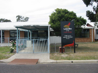
Latrobe Valley Regional Airport |
|
|
 Operator: LaTrobe Regional Airport Management Committee
Address:
PO Box 3310,
Mail Centre
Morwell VIC 3310
Australia
Phone: +61 3 51744702
Fax: +61 3 51743526
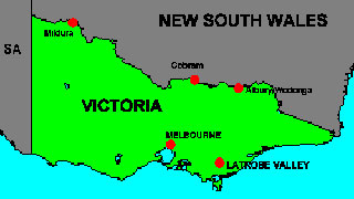
The Latrobe Valley is situated east of Melbourne, Victoria. The region
offers many attractions such as lakes for boating, sailing, skiing, swimming,
or just a pleasant picnic by the water, several golf courses to choose
from, major shopping centres and town centre shopping, parks and gardens,
including the well known Morwell Rose Gardens.
 Latrobe Regional Airport Security Assessment
Airbiz, in conjunction with Intelligent Outcomes Group (IOG), recently
completed a security threat and risk assessment of Latrobe Regional Airport
in Gippsland, Victoria.
Latrobe Regional Airport lies in the heart of the Latrobe Valley, the
centre for Victoria's power generation infrastructure. The airport is
also home to Gippsland Aeronautics, Australia's only OEM aircraft manufacturer,
and home to numerous GA and historic aircraft. REX services the airport
daily, to Sydney and Canberra.
Latrobe Regional Airport's assessment investigated many common, but often
unaddressed, threats and risks facing all airports today. These included
access by unauthorised people, risk of vandalism and theft of property
and risk of politically motivated actions.
As well as working with airport management, Airbiz and IOG consulted widely
throughout the local community including Latrobe City Council, Victorian
Police and local power stations.
Airport Management were pleased with the practical and achievable recommendations
of the project that addressed the issues uniquely relating to Latrobe
Regional Airport.
URL: Latrobe
Valley Regional Airport
Images and information placed above are from
Latrobe
Valley Regional Airport
We thank them for the data!
| General Info
|
| Country |
Australia
|
| ICAO ID |
YLTV
|
| Time |
UTC+10(+11DT)
|
| Latitude |
-38.207222
38° 12' 26.00" S
|
| Longitude |
146.470278
146° 28' 13.00" E
|
| Elevation |
180 feet
55 meters
|
| Magnetic Variation |
012° E (01/04)
|
| Operating Agency |
CIVIL GOVERNMENT, (LANDING FEES AND DIPLOMATIC CLEARANCE MAY BE REQUIRED)
|
| Communications
|
UNICOM
Opr 2230-0730Z++
|
126.0
|
| MELBOURNE CNTR |
124.0
|
| CTAF |
126.0
|
| Communications Remarks |
|
| FSS |
(on gnd)
|
| CTAF |
Nstd 10 NM rad to 5000'.
|
| Runways
|
| ID |
Dimensions |
Surface |
PCN |
ILS
|
| 03/21 |
4692 x 75 feet
1430 x 23 meters |
ASPHALT |
- |
NO
|
| 09/27 |
3015 x 60 feet
919 x 18 meters |
GRAVEL. |
- |
NO
|
| Navaids
|
| Type |
ID |
Name |
Channel |
Freq |
Distance From Field |
Bearing From Navaid
|
| NDB |
LTV |
LATROBE VALLEY |
- |
486 |
At Field |
-
|
| Supplies/Equipment
|
| Fuel |
Jet A1, without icing nhibitor.
100/130 MIL Spec, low lead, aviation gasoline (BLUE)
|
| Oil |
O-117, 1100, Reciprocating Engine Oil (MIL L 6082)
|
| Remarks
|
| CAUTION |
Bird haz. Due to rwy levels acft may not be visible on opposite rwy ends. PJE within 5 NM to 12,000'. Glider OPS SR-SS.
|
| FUEL |
Avbl 2200-0730Z++, OT PN, fone C03 51742591. (NC-100LL, A1)
|
| LGT |
ACTIVATE-Rwy 03-21-122.3. Portable lgt emerg only.
|
| OIL |
O-117
|
| RSTD |
Arpt not avbl to acft abv 12,500 lb GWT wo prior perms.
|
Runway 03/21
4692 x 75 feet
1430 x 23 meters
| Runway 03
|
| Surface |
ASPHALT
|
| True Heading |
045.0
|
| Latitude |
-38.215525
38° 12' 55.89" S
|
| Longitude |
146.465053
146° 27' 54.19" E
|
| Elevation |
171.0 feet
52 meters
|
| Slope |
0.2°
|
| Landing Distance |
4692 feet
1430 meters
|
| Takeoff Distance |
4692 feet
1430 meters
|
| Lighting System |
PCL
LIRL
PORTABLE |
| Runway 21
|
| Surface |
ASPHALT
|
| True Heading |
225.0
|
| Latitude |
-38.206436
38° 12' 23.17" S
|
| Longitude |
146.476628
146° 28' 35.86" E
|
| Elevation |
182.0 feet
55 meters
|
| Slope |
-0.2°
|
| Landing Distance |
4692 feet
1430 meters
|
| Takeoff Distance |
4692 feet
1430 meters
|
| Lighting System |
PCL
LIRL
PORTABLE |
Runway 09/27
3015 x 60 feet
919 x 18 meters
| Runway 09
|
| Surface |
GRAVEL.
|
| True Heading |
097.0
|
| Latitude |
-38.205111
38° 12' 18.40" S
|
| Longitude |
146.465369
146° 27' 55.33" E
|
| Elevation |
157.0 feet
48 meters
|
| Slope |
0.8°
|
| Landing Distance |
3015 feet
919 meters
|
| Takeoff Distance |
3015 feet
919 meters
|
| Lighting System |
PORTABLE
|
| Runway 27
|
| Surface |
GRAVEL.
|
| True Heading |
277.0
|
| Latitude |
-38.206142
38° 12' 22.11" S
|
| Longitude |
146.475786
146° 28' 32.83" E
|
| Elevation |
182.0 feet
55 meters
|
| Slope |
-0.8°
|
| Landing Distance |
3015 feet
919 meters
|
| Takeoff Distance |
3015 feet
919 meters
|
| Lighting System |
PORTABLE
|
Navaids
| LATROBE VALLEY
|
| Type |
ID |
Channel |
Freq |
Country |
State
|
| NDB |
LTV |
- |
486 |
Australia |
-
|
| Latitude |
Longitude |
Airport
|
-38.213611
38° 12' 49.00" S |
146.475000
146° 28' 30.00" E |
YLTV
|
The content above was published at Airports-Worldwide.com in 2004-2006.
We don't guarantee the information is fresh and accurate. The data may be wrong or outdated.
For more up-to-date information please refer to other sources.
|
 |


