 |
|
|
|
|
|
 Operator: Kempsey Shire Council
Airport Code: KPS
GMT Offset: -10.0
Address:
PO Box 78
West Kempsey NSW 2440
Australia
Phone: +61 2 65626077
Kempsey leads you all the way to clear aquamarine waters, tiny coves, a peaceful bay, lush, green forests fringed by light-coloured sands. Over 80% of the Macleay's Valleys coastline is protected by national parks and reserves. The Airport is located 6km from the town centre.
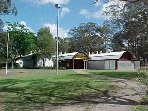
The history of the Macleay Valley is as fascinating as it is diverse and one of the best ways to appreciate it is to visit the Macleay River Historical Society-s award winning Museum in South Kempsey. The museum, housed in the unique Glenn Murcutt Building adjacent to the Visitor Information Centre, traces the valleys history from the time of the Aborigines to today.
History is vested in the Dunghutti people, a group who shared a common language and who organised themselves into smaller groups regularly living together. They lived in harmony with the land and their pattern of life was governed by codes of conduct regarded as sacred, having been handed down through countless generations. Remnants of their ancient culture remain in our valley - middens and a fish trap in the Limeburners Creek Nature Reserve and a bora ring at Richardsons Crossing just north of Crescent Head.
The earliest European settlement was recorded in 1827 when Captain A.C. Innes, the commandant at Port Macquarie, established a cedar party north of Euroka Creek on the Macleay River. The first land grants were surveyed on the east bank of the Macleay in 1835. Samuel Onions- grant of 802 acres was sold to Enoch William Rudder, a merchant from Birmingham who became Kempsey-s first white settler. He surveyed the land for a private town which he named Kempsey as he found the countryside reminiscent of the valley of Kempsey in Worcestershire, England. Rudder Park, in East Kempsey, is the site of this first settler-s home. The park, featuring a lookout, was first developed by the local Apex Club and commands a majestic view of the surrounding mountains, the town and the river. The Macleay River Historical Society has signified the site by the placing of an historic marker. The first vehicular ferry operated nearby in 1842. The fine stands of cedar and rosewood timbers attracted the first residents, but timber was followed by grazing and land was leased on payment of an annual licence fee. These ?old runs� were later surveyed and the land purchased. Farming was extensively carried out on the lower reaches of the Macleay. Sugar cane was tried but failed when frosts killed the plants. Dairying started in earnest early this century and maize growing has always been an important staple industry. Beef continues to be a major product. Bullock and horse teams were the carriers of early times and shipping played a major role in transport. Up until 1893, the entrance to the Macleay River was at Grassy Head and droghers regularly plied the river carrying produce to meet the ocean going ships which tied up at Kempsey wharf. The railway edged north to the town in 1917.
In 1886, the borough of Kempsey was proclaimed. This name remained until the Municipality of Kempsey was established in 1907 with the formation of the Macleay Shire. Today, the local government body is Kempsey Shire Council which embraces the entire Macleay district.
Images and information placed above are from
www.airportsaustralia.com
We thank them for the data!
| General Info
|
| Country |
Australia
|
| ICAO ID |
YKMP
|
| Time |
UTC+10(+11DT)
|
| Latitude |
-31.074444
31° 04' 28.00" S
|
| Longitude |
152.769722
152° 46' 11.00" E
|
| Elevation |
54 feet
16 meters
|
| Magnetic Variation |
012° E (01/04)
|
| Operating Agency |
CIVIL GOVERNMENT, (LANDING FEES AND DIPLOMATIC CLEARANCE MAY BE REQUIRED)
|
| Communications
|
| BRISBANE CNTR |
120.55
|
| CTAF |
118.1
|
| Communications Remarks |
|
| FSS |
(3500', for circuit area and on gnd ctc Brisbane Cntr 120.95)
|
| Runways
|
| ID |
Dimensions |
Surface |
PCN |
ILS
|
| 04/22 |
5413 x 98 feet
1650 x 30 meters |
ASPHALT |
009FBZU |
NO
|
| 16/34 |
2014 x 60 feet
614 x 18 meters |
GRASS OR EARTH NOT GRADED OR ROLLED. |
- |
NO
|
| Navaids
|
| Type |
ID |
Name |
Channel |
Freq |
Distance From Field |
Bearing From Navaid
|
| NDB |
KMP |
KEMPSEY |
- |
230 |
1.4 NM |
215.1
|
| Supplies/Equipment
|
| Fuel |
100/130 MIL Spec, low lead, aviation gasoline (BLUE)
|
| Remarks
|
| CAUTION |
Kangaroo haz.
|
| FUEL |
Avbl 1 hr PN, fone C02 65624858. (NC-100LL)
|
| LGT |
ACTIVATE-Rwy 04-22-119.6.
|
Runway 04/22
5413 x 98 feet
1650 x 30 meters
| Runway 04
|
| Surface |
ASPHALT
|
| True Heading |
054.0
|
| Latitude |
-31.076539
31° 04' 35.54" S
|
| Longitude |
152.758442
152° 45' 30.39" E
|
| Landing Distance |
5413 feet
1650 meters
|
| Takeoff Distance |
5613 feet
1711 meters
|
| Overrun Length |
200 feet
61 meters
|
| Overrun Surface |
GRADED OR ROLLED EARTH, GRASS ON GRADED EARTH.
|
| Lighting System |
PCL
LIRL |
| Runway 22
|
| Surface |
ASPHALT
|
| True Heading |
234.0
|
| Latitude |
-31.067894
31° 04' 04.42" S
|
| Longitude |
152.772458
152° 46' 20.85" E
|
| Landing Distance |
5413 feet
1650 meters
|
| Takeoff Distance |
5613 feet
1711 meters
|
| Overrun Length |
200 feet
61 meters
|
| Overrun Surface |
GRADED OR ROLLED EARTH, GRASS ON GRADED EARTH.
|
| Lighting System |
PCL
LIRL |
Runway 16/34
2014 x 60 feet
614 x 18 meters
| Runway 16
|
| Surface |
GRASS OR EARTH NOT GRADED OR ROLLED.
|
| True Heading |
171.0
|
| Latitude |
-31.068819
31° 04' 07.75" S
|
| Longitude |
152.768581
152° 46' 06.89" E
|
| Landing Distance |
1535 feet
468 meters
|
| Takeoff Distance |
2014 feet
614 meters
|
| Displaced Threshold Length |
479 feet
146 meters
|
| Runway 34
|
| Surface |
GRASS OR EARTH NOT GRADED OR ROLLED.
|
| True Heading |
351.0
|
| Latitude |
-31.074353
31° 04' 27.67" S
|
| Longitude |
152.769653
152° 46' 10.75" E
|
| Landing Distance |
2014 feet
614 meters
|
| Takeoff Distance |
2014 feet
614 meters
|
Navaids
| KEMPSEY
|
| Type |
ID |
Channel |
Freq |
Country |
State
|
| NDB |
KMP |
- |
230 |
Australia |
-
|
| Latitude |
Longitude |
Airport
|
-31.058333
31° 03' 30.00" S |
152.790000
152° 47' 24.00" E |
YKMP
|
The content above was published at Airports-Worldwide.com in 2004-2006.
We don't guarantee the information is fresh and accurate. The data may be wrong or outdated.
For more up-to-date information please refer to other sources.
|
 |


