 |
|
|
|
|
|
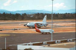
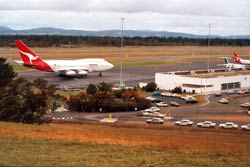 In addition to domestic and general aviation operations, Hobart Airport, located just 17 kilometres from Australia's southern most capital city, provides an international gateway to the island State's famous heritage.
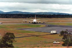
One of few cities in Australia to enjoy curfew-free air services, Hobart Airport covers an area of 498 hectares on a plain between Frederick Henry Bay and Barilla Bay. It has a single, sealed runway, 2251 m long and 45 m wide, and is equipped with sophisticated radio navigation and landing infrastructure.
 The Hobart International Airport is operated by Hobart International Airport Pty Ltd (HIAPL). HIAPL has a 99 year lease on the airport which commenced on the 11th of June 1998.
Hobart International Airport has land available for commercial development. Enquiries or expressions of interest can be directed to Robert Noga on (03) 6216 1630
 Hobart International Airport Pty Ltd
A.C.N 080 919 777
A.B.N 27 080 919 777:
Addresss:
Box 1
Strachan Street
Hobart International Airport
Cambridge
Tasmania 7170
Australia
Phone: 03 6216 1600 (International 61 3 6216 1600)
Fax: 03 6248 5540 (International 61 3 6248 5540)
Email: info at hobartairpt com au
URL: www.hobartairpt com au
Images and information placed above are from
www.hobartairpt com au
We thank them for the data!
| General Info
|
| Country |
Australia
|
| ICAO ID |
YMHB
|
| Time |
UTC+10(+11DT)
|
| Latitude |
-42.836111
42° 50' 10.00" S
|
| Longitude |
147.510278
147° 30' 37.00" E
|
| Elevation |
13 feet
4 meters
|
| Type |
Civil
|
| Magnetic Variation |
014° E (01/04)
|
| Beacon |
Yes
|
| Operating Agency |
CIVIL GOVERNMENT, (LANDING FEES AND DIPLOMATIC CLEARANCE MAY BE REQUIRED)
|
| International Clearance Status |
Airport of Entry
|
| Communications
|
| TWR |
118.1
|
MTAF
Outside twr hrs.
|
118.1
|
MELBOURNE CNTR
Outside twr hrs.
|
125.55
|
| ATIS |
112.7
128.45
|
| Communications Remarks |
|
| FSS |
(on gnd)
|
| TWR |
TWR opr hrs by NOTAM. Also provides info for Hobart Cambridge Arpt dur Twr hrs.
|
| MISC |
Nstd 30 NM rad to 6000'.
|
| ATIS |
Also provides info for Hobart Cambridge Arpt tfc dur Twr hrs.
|
| Runways
|
| ID |
Dimensions |
Surface |
PCN |
ILS
|
| 12/30 |
7385 x 148 feet
2251 x 45 meters |
ASPHALT |
063FDXT |
YES
|
| Navaids
|
| Type |
ID |
Name |
Channel |
Freq |
Distance From Field |
Bearing From Navaid
|
| VOR-DME |
HB |
HOBART |
074X |
112.7 |
At Field |
-
|
| NDB |
TTR |
TEA TREE |
- |
374 |
12.2 NM |
120.3
|
| Supplies/Equipment
|
| Fuel |
Jet A1, without icing nhibitor.
100/130 MIL Spec, low lead, aviation gasoline (BLUE)
|
| Oil |
O-156, MIL L 23699 (Synthetic Base)Turboprop/Turboshaft Engine
|
| Remarks
|
| CAUTION |
Bird haz.
|
| FUEL |
Avbl 2200-0000Z++ Mon-Fri; OT O/R, fone C03 62485049. (NC-100LL, A1)
|
| LGT |
ACTIVATE-Rwy 12-30-118.1.
|
| MISC |
Rwy 12-30 grooved.
|
| OIL |
O-156
|
| RSTD |
Special dep pro Rwy 30.
|
Runway 12/30
7385 x 148 feet
2251 x 45 meters
| Runway 12
|
| Surface |
ASPHALT
|
| True Heading |
134.0
|
| Latitude |
-42.828978
42° 49' 44.32" S
|
| Longitude |
147.502061
147° 30' 07.42" E
|
| Elevation |
12.0 feet
4 meters
|
| Slope |
0.0°
|
| Landing Distance |
7385 feet
2251 meters
|
| Takeoff Distance |
7385 feet
2251 meters
|
| Lighting System |
PCL
HIRL
J
VA |
| Runway 30
|
| Surface |
ASPHALT
|
| True Heading |
314.0
|
| Latitude |
-42.843344
42° 50' 36.04" S
|
| Longitude |
147.521489
147° 31' 17.36" E
|
| Elevation |
12.0 feet
4 meters
|
| Slope |
0.0°
|
| Landing Distance |
7385 feet
2251 meters
|
| Takeoff Distance |
7385 feet
2251 meters
|
| Lighting System |
PCL
LIRL
VA |
Navaids
| HOBART
|
| Type |
ID |
Channel |
Freq |
Country |
State
|
| VORTAC |
HBR |
055X |
111.8 |
United States |
OKLAHOMA
|
| Latitude |
Longitude |
Airport
|
34.866589
34° 51' 59.72" N |
-99.063383
099° 03' 48.18" W |
AXS
|
| HOBART
|
| Type |
ID |
Channel |
Freq |
Country |
State
|
| NDB |
HB |
- |
362 |
Australia |
-
|
| Latitude |
Longitude |
Airport
|
-42.812300
42° 48' 44.28" S |
147.479450
147° 28' 46.02" E |
YMHB
|
| HOBART
|
| Type |
ID |
Channel |
Freq |
Country |
State
|
| VOR-DME |
HB |
074X |
112.7 |
Australia |
-
|
| Latitude |
Longitude |
Airport
|
-42.847125
42° 50' 49.65" S |
147.526667
147° 31' 36.00" E |
YMHB
|
Navaids
| TEA TREE
|
| Type |
ID |
Channel |
Freq |
Country |
State
|
| NDB |
TTR |
- |
374 |
Australia |
-
|
| Latitude |
Longitude |
Airport
|
-42.692222
42° 41' 32.00" S |
147.313889
147° 18' 50.00" E |
YMHB
|
The content above was published at Airports-Worldwide.com in 2004-2006.
We don't guarantee the information is fresh and accurate. The data may be wrong or outdated.
For more up-to-date information please refer to other sources.
|
 |


