 |
 |
|
||||
|
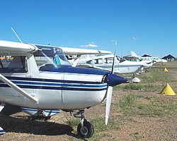
Images and information placed above are from www.airportsaustralia.com We thank them for the data!
Runway 11/295400 x 98 feet
|
|||||||||||||||||||||||||||||||||||||||||||||||||||||||||||||||||||||||||||||||||||||||||||||||||||||||||||||||||||||||||||||||||||||||||||||||||||||||||||||||||||||||||||||||||||||||||||||||||||||||||||||||||||||||||||||||||||||||||||||
| Runway 11 | |
|---|---|
| Surface | ASPHALT |
| True Heading | 123.0 |
| Latitude | -30.953600 30° 57' 12.96" S |
| Longitude | 150.240594 150° 14' 26.14" E |
| Elevation | 859.0 feet 262 meters |
| Slope | 0.1° |
| Landing Distance | 5400 feet 1646 meters |
| Takeoff Distance | 5600 feet 1707 meters |
| Overrun Length | 200 feet 61 meters |
| Overrun Surface | GRADED OR ROLLED EARTH, GRASS ON GRADED EARTH. |
| Lighting System | PCL
LIRL |
| Runway 29 | |
|---|---|
| Surface | ASPHALT |
| True Heading | 303.0 |
| Latitude | -30.961631 30° 57' 41.87" S |
| Longitude | 150.255094 150° 15' 18.34" E |
| Elevation | 863.0 feet 263 meters |
| Slope | -0.1° |
| Landing Distance | 5400 feet 1646 meters |
| Takeoff Distance | 5600 feet 1707 meters |
| Overrun Length | 200 feet 61 meters |
| Overrun Surface | GRADED OR ROLLED EARTH, GRASS ON GRADED EARTH. |
| Lighting System | PCL
LIRL |
| Runway 17 | |
|---|---|
| Surface | GRASS OR EARTH NOT GRADED OR ROLLED. |
| True Heading | 183.0 |
| Latitude | -30.955214 30° 57' 18.77" S |
| Longitude | 150.250956 150° 15' 03.44" E |
| Elevation | 858.0 feet 262 meters |
| Slope | 0.1° |
| Landing Distance | 1942 feet 592 meters |
| Takeoff Distance | 2142 feet 653 meters |
| Overrun Length | 200 feet 61 meters |
| Overrun Surface | GRADED OR ROLLED EARTH, GRASS ON GRADED EARTH. |
| Runway 35 | |
|---|---|
| Surface | GRASS OR EARTH NOT GRADED OR ROLLED. |
| True Heading | 003.0 |
| Latitude | -30.960542 30° 57' 37.95" S |
| Longitude | 150.250664 150° 15' 02.39" E |
| Elevation | 860.0 feet 262 meters |
| Slope | -0.1° |
| Landing Distance | 1942 feet 592 meters |
| Takeoff Distance | 2142 feet 653 meters |
| Overrun Length | 200 feet 61 meters |
| Overrun Surface | GRADED OR ROLLED EARTH, GRASS ON GRADED EARTH. |
| GUNNEDAH | |||||
|---|---|---|---|---|---|
| Type | ID | Channel | Freq | Country | State |
| NDB | GDH | - | 407 | Australia | - |
| Latitude | Longitude | Airport |
| -30.954167 30° 57' 15.00" S |
150.248333 150° 14' 54.00" E |
YGDH |
The content above was published at Airports-Worldwide.com in 2004-2006.
We don't guarantee the information is fresh and accurate. The data may be wrong or outdated.
For more up-to-date information please refer to other sources.

 |
|
Copyright 2004-2024 © by Airports-Worldwide.com, Vyshenskoho st. 36, Lviv 79010, Ukraine Legal Disclaimer |
 Operator: Gunnedah Shire Council