 |
 |
|
||||
|
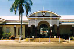
Images and information placed above are from Emerald Airport We thank them for the data!
Runway 06/246234 x 98 feet
|
|||||||||||||||||||||||||||||||||||||||||||||||||||||||||||||||||||||||||||||||||||||||||||||||||||||||||||||||||||||||||||||||||||||||||||||||||||||||||||||||||||||||||||||||||||||||||||||||||||||||||||||||||||||||||||||||||
| Runway 06 | |
|---|---|
| Surface | ASPHALT |
| True Heading | 070.0 |
| Latitude | -23.572208 23° 34' 19.95" S |
| Longitude | 148.171114 148° 10' 16.01" E |
| Elevation | 620.0 feet 189 meters |
| Slope | -0.2° |
| Landing Distance | 6234 feet 1900 meters |
| Takeoff Distance | 6234 feet 1900 meters |
| Lighting System | PCL
LIRL PAPI PORTABLE |
| Runway 24 | |
|---|---|
| Surface | ASPHALT |
| True Heading | 250.0 |
| Latitude | -23.566475 23° 33' 59.31" S |
| Longitude | 148.188661 148° 11' 19.18" E |
| Elevation | 605.0 feet 184 meters |
| Slope | 0.2° |
| Landing Distance | 6234 feet 1900 meters |
| Takeoff Distance | 6234 feet 1900 meters |
| Lighting System | PCL
LIRL PAPI PORTABLE |
| Runway 15 | |
|---|---|
| Surface | GRAVEL. |
| True Heading | 151.0 |
| Latitude | -23.564850 23° 33' 53.46" S |
| Longitude | 148.174808 148° 10' 29.31" E |
| Elevation | 611.0 feet 186 meters |
| Slope | 0.1° |
| Landing Distance | 3038 feet 926 meters |
| Takeoff Distance | 3038 feet 926 meters |
| Lighting System | PORTABLE |
| Runway 33 | |
|---|---|
| Surface | GRAVEL. |
| True Heading | 331.0 |
| Latitude | -23.572203 23° 34' 19.93" S |
| Longitude | 148.179178 148° 10' 45.04" E |
| Elevation | 615.0 feet 187 meters |
| Slope | -0.1° |
| Landing Distance | 3038 feet 926 meters |
| Takeoff Distance | 3038 feet 926 meters |
| Lighting System | PORTABLE |
| EMERALD | |||||
|---|---|---|---|---|---|
| Type | ID | Channel | Freq | Country | State |
| NDB | EML | - | 324 | Australia | - |
| Latitude | Longitude | Airport |
| -23.567500 23° 34' 03.00" S |
148.171111 148° 10' 16.00" E |
YEML |
The content above was published at Airports-Worldwide.com in 2004-2006.
We don't guarantee the information is fresh and accurate. The data may be wrong or outdated.
For more up-to-date information please refer to other sources.

 |
|
Copyright 2004-2024 © by Airports-Worldwide.com, Vyshenskoho st. 36, Lviv 79010, Ukraine Legal Disclaimer |
 Operator: Emerald Shire Council