 |
 |
|
||||
|
Images and information placed above are from www.airportsaustralia.com We thank them for the data!
Runway 03/213825 x 60 feet
|
|||||||||||||||||||||||||||||||||||||||||||||||||||||||||||||||||||||||||||||||||||||||||||||||||||||||||||||||||||||||||||||||||||||||||||||||||||||||||||||||||||||||||||||||||||||||||||||||||||||||||||||||||||||||||||||||||||||||||||||||||
| Runway 03 | |
|---|---|
| Surface | GRADED OR ROLLED EARTH, GRASS ON GRADED EARTH. |
| True Heading | 041.0 |
| Latitude | -33.846414 33° 50' 47.09" S |
| Longitude | 148.643375 148° 38' 36.15" E |
| Elevation | 955.0 feet 291 meters |
| Slope | 0.3° |
| Landing Distance | 3825 feet 1166 meters |
| Takeoff Distance | 3825 feet 1166 meters |
| Runway 21 | |
|---|---|
| Surface | GRADED OR ROLLED EARTH, GRASS ON GRADED EARTH. |
| True Heading | 221.0 |
| Latitude | -33.838503 33° 50' 18.61" S |
| Longitude | 148.651653 148° 39' 05.95" E |
| Elevation | 966.0 feet 294 meters |
| Slope | -0.3° |
| Landing Distance | 3825 feet 1166 meters |
| Takeoff Distance | 3825 feet 1166 meters |
| Runway 15 | |
|---|---|
| Surface | ASPHALT |
| True Heading | 161.0 |
| Latitude | -33.839211 33° 50' 21.16" S |
| Longitude | 148.644889 148° 38' 41.60" E |
| Elevation | 960.0 feet 293 meters |
| Slope | 0.1° |
| Landing Distance | 5348 feet 1630 meters |
| Takeoff Distance | 5348 feet 1630 meters |
| Lighting System | PCL
LIRL |
| Runway 33 | |
|---|---|
| Surface | ASPHALT |
| True Heading | 341.0 |
| Latitude | -33.853144 33° 51' 11.32" S |
| Longitude | 148.650489 148° 39' 01.76" E |
| Elevation | 966.0 feet 294 meters |
| Slope | -0.1° |
| Landing Distance | 5348 feet 1630 meters |
| Takeoff Distance | 5348 feet 1630 meters |
| Lighting System | PCL
LIRL |
| COWRA | |||||
|---|---|---|---|---|---|
| Type | ID | Channel | Freq | Country | State |
| NDB | CWR | - | 299 | Australia | - |
| Latitude | Longitude | Airport |
| -33.844875 33° 50' 41.55" S |
148.653256 148° 39' 11.72" E |
YCWR |
| COWRA | |||||
|---|---|---|---|---|---|
| Type | ID | Channel | Freq | Country | State |
| VOR | CWR | - | 112.4 | Australia | - |
| Latitude | Longitude | Airport |
| -33.847900 33° 50' 52.44" S |
148.645531 148° 38' 43.91" E |
YCWR |
The content above was published at Airports-Worldwide.com in 2004-2006.
We don't guarantee the information is fresh and accurate. The data may be wrong or outdated.
For more up-to-date information please refer to other sources.

 |
|
Copyright 2004-2024 © by Airports-Worldwide.com, Vyshenskoho st. 36, Lviv 79010, Ukraine Legal Disclaimer |
 Operator: Cowra Shire Council
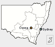
  Cowra is located 225km due west of Sydney with the airport just 3.5 km
from the the town centre. The region is well known for it's wine production
and is the 5th largest wine grape growing area in New South Wales.
Cowra is located 225km due west of Sydney with the airport just 3.5 km
from the the town centre. The region is well known for it's wine production
and is the 5th largest wine grape growing area in New South Wales.