 |
 |
|
||||
|
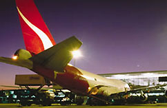
Images and information placed above are from Coolangatta Airport We thank them for the data!
Runway 14/326699 x 148 feet
|
|||||||||||||||||||||||||||||||||||||||||||||||||||||||||||||||||||||||||||||||||||||||||||||||||||||||||||||||||||||||||||||||||||||||||||||||||||||||||||||||||||||||||||||||||||||||||||||||||||||||||||||||||||||||||||||||||||||||||||||||||||||||||||||||||||||||||||||||||||||||||||
| Runway 14 | |
|---|---|
| Surface | ASPHALT |
| True Heading | 151.0 |
| Latitude | -28.156500 28° 09' 23.40" S |
| Longitude | 153.500731 153° 30' 02.63" E |
| Elevation | 21.0 feet 6 meters |
| Slope | -0.1° |
| Landing Distance | 6699 feet 2042 meters |
| Takeoff Distance | 6899 feet 2103 meters |
| Overrun Length | 200 feet 61 meters |
| Overrun Surface | GRAVEL. |
| Lighting System | PCL
MIRL REIL VA |
| Runway 32 | |
|---|---|
| Surface | ASPHALT |
| True Heading | 331.0 |
| Latitude | -28.172561 28° 10' 21.22" S |
| Longitude | 153.510944 153° 30' 39.40" E |
| Elevation | 13.0 feet 4 meters |
| Slope | 0.1° |
| Landing Distance | 6699 feet 2042 meters |
| Takeoff Distance | 6899 feet 2103 meters |
| Overrun Length | 200 feet 61 meters |
| Overrun Surface | GRAVEL. |
| Lighting System | PCL
MIRL REIL VA |
| Runway 17 | |
|---|---|
| Surface | ASPHALT |
| True Heading | 184.0 |
| Latitude | -28.164356 28° 09' 51.68" S |
| Longitude | 153.506753 153° 30' 24.31" E |
| Elevation | 17.0 feet 5 meters |
| Slope | -0.2° |
| Landing Distance | 1909 feet 582 meters |
| Takeoff Distance | 2109 feet 643 meters |
| Overrun Length | 200 feet 61 meters |
| Overrun Surface | SAND, GRADED, ROLLED OR OILED. |
| Runway 35 | |
|---|---|
| Surface | ASPHALT |
| True Heading | 004.0 |
| Latitude | -28.169594 28° 10' 10.54" S |
| Longitude | 153.506331 153° 30' 22.79" E |
| Elevation | 13.0 feet 4 meters |
| Slope | 0.2° |
| Landing Distance | 1909 feet 582 meters |
| Takeoff Distance | 1909 feet 582 meters |
| COOLANGATTA | |||||
|---|---|---|---|---|---|
| Type | ID | Channel | Freq | Country | State |
| NDB | CG | - | 278 | Australia | - |
| Latitude | Longitude | Airport |
| -28.164858 28° 09' 53.49" S |
153.501114 153° 30' 04.01" E |
YBCG |
| COOLANGATTA | |||||
|---|---|---|---|---|---|
| Type | ID | Channel | Freq | Country | State |
| VOR-DME | CG | 070X | 112.3 | Australia | - |
| Latitude | Longitude | Airport |
| -28.168900 28° 10' 08.04" S |
153.503886 153° 30' 13.99" E |
YBCG |
The content above was published at Airports-Worldwide.com in 2004-2006.
We don't guarantee the information is fresh and accurate. The data may be wrong or outdated.
For more up-to-date information please refer to other sources.

 |
|
Copyright 2004-2024 © by Airports-Worldwide.com, Vyshenskoho st. 36, Lviv 79010, Ukraine Legal Disclaimer |
 Operator: Gold Coast Airport Limited
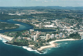 If you like sun, surf and sand, unpolluted air and a relaxed lifestyle, then you/ll love the Gold Coast! Coolangatta Airport is located on the Gold Coast is serviced by Domestic Flights. The distance from the Coolangatta Airport to Surfers Paradise is approximately 20kms. International Flights arrive in Brisbane at the International Terminal which is approximately 80kms from the Gold Coast. Shuttle Buses are available to the heart of the Gold Coast with light aircraft and helicopters available for rental at the Airport.